
Lac du Montagnon d'Iseye
- Thématique Randonnée
- Mis à jour le 31/07/2020
- Identifiant 1051615
Sélectionner le fond de carte

PLAN IGN

PHOTOS AERIENNES

CARTES IGN MULTI-ECHELLES

TOP 25 IGN

CARTES DES PENTES

PARCELLES CADASTRALES

CARTES OACI

CARTES 1950 IGN

CARTE DE L’ETAT-MAJOR (1820-1866)

Open Street Map
Afficher les points d'intérêt à proximité
Hébergements
Informations
Lieux d'intérêts
Producteurs
Restauration
Services et Commerces
Autre
Echelle
|
durée / niveau
Rando pédestre
|
distance
10,3 km
type parcours
Aller/Retour
|
|||||||||
|
Lieu de départ
64490 Aydius
|
accessibilite
|
|||||||||
|
prestations payantes
Non
|
type(s) de sol
Terre
Herbe Rochers |
|||||||||
description
Départ d'Aydius par la route des Salars : accéder au parking avant 9 h.
Déviation au col de la Taillandière : ne pas suivre la trace GPS mais le balisage passant plus à gauche (risque d'éboulements).
Déviation au col de la Taillandière : ne pas suivre la trace GPS mais le balisage passant plus à gauche (risque d'éboulements).
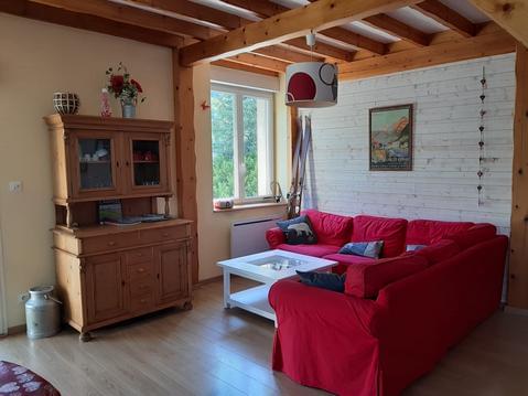
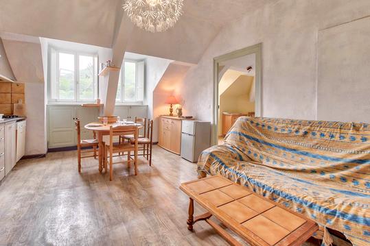
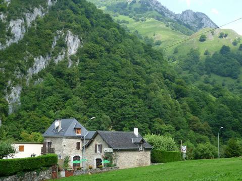
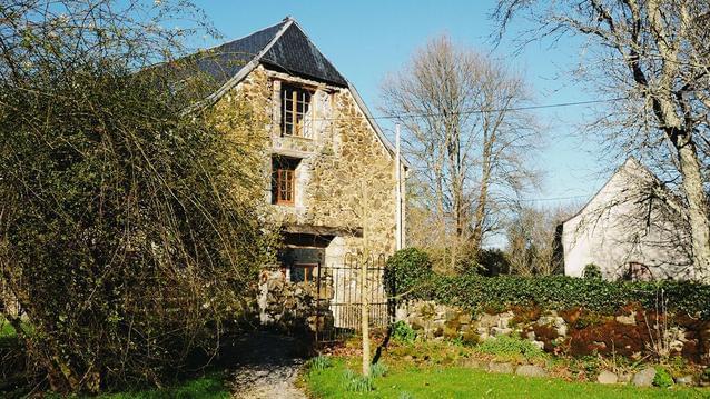
Hébergements à proximité


Accès au parking
Avant 9 h sous peine d'une amende 1400 E.
Respecter les emplacements en nombre limité
Respecter les emplacements en nombre limité
infos parcours (9)
1
Cairn de Départ (bord de la route)
Cairn de Départ (bord de la route)20-AOU-11 14:44:30
Informations complémentaires
kilomètre
0,10
latitude
42.9945
altitude
1066
m
longitude
-0.507458
2
L'Arigalos (Ruisseau)
L'Arigalos (Ruisseau)20-AOU-11 14:39:48
Informations complémentaires
kilomètre
0,13
latitude
42.9927
altitude
1105
m
longitude
-0.507578
3
Crête de Barca
Crête de Barca
Informations complémentaires
kilomètre
1,20
latitude
42.9843
altitude
1436
m
longitude
-0.506637
4
Cabane-Cure-Det-Cam-1585m
Cabane-Cure-Det-Cam-1585m
Informations complémentaires
kilomètre
2,09
latitude
42.9787
altitude
1589
m
longitude
-0.498354
5
Col-Taillandère-1836m
Col-Taillandère-1836m
Informations complémentaires
kilomètre
3,50
latitude
42.9691
altitude
1833
m
longitude
-0.490973
6
L'Escala
L'Escala
Informations complémentaires
kilomètre
4,08
latitude
42.9659
altitude
1957
m
longitude
-0.491037
7
Lac-Montagnon-2003m
Lac-Montagnon-2003m
Informations complémentaires
kilomètre
4,13
latitude
42.9673
altitude
2000
m
longitude
-0.49535
8
Montagnon-D-Iseye-2173m
Montagnon-D-Iseye-2173m
Informations complémentaires
kilomètre
4,97
latitude
42.9693
altitude
2143
m
longitude
-0.49784
9
Pic-Mardas-2188m
Pic-Mardas-2188m
Informations complémentaires
kilomètre
5,42
latitude
42.9654
altitude
2180
m
longitude
-0.498784
Alain
Note moyenne
Cartes associées
