
CHATAS - EOLIENNES - 4 bornes
- Mis à jour le 10/08/2020
- Identifiant 1061526
Sélectionner le fond de carte

PLAN IGN

PHOTOS AERIENNES

CARTES IGN MULTI-ECHELLES

TOP 25 IGN

CARTES DES PENTES

PARCELLES CADASTRALES

CARTES OACI

CARTES 1950 IGN

CARTE DE L’ETAT-MAJOR (1820-1866)

Open Street Map
Afficher les points d'intérêt à proximité
Hébergements
Informations
Lieux d'intérêts
Producteurs
Restauration
Services et Commerces
Autre
Echelle
|
durée / niveau
Rando pédestre
|
distance
11,7 km
type parcours
Boucle
|
|||||||||
|
Lieu de départ
14 le village
88210 Châtas |
accessibilite
|
|||||||||
|
prestations payantes
Non
|
type(s) de sol
Bitume
Graviers Terre |
|||||||||
Photos & vidéos (5)
|
|
|
|
|
description
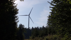
Circuit permettant d'approcher les 5 éoliennes C01 à C05 et de voir celles du coté de SAALES.
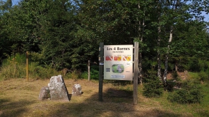
Passage par le Col des Broques et les Quatre Bornes.
Attention aux chutes sur les cailloux.
Passage par le Col des Broques et les Quatre Bornes.
Attention aux chutes sur les cailloux.
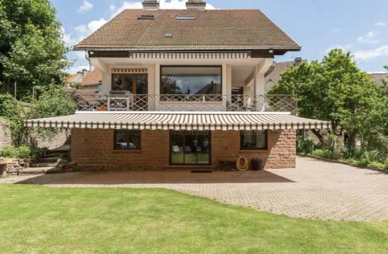
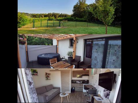
Hébergements à proximité


infos parcours (13)
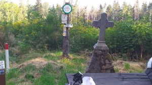
1
Croix Didion
Informations complémentaires
kilomètre
1,13
latitude
48.3701
altitude
599
m
longitude
7.03421
2
Depart circuit parking a100m
Informations complémentaires
kilomètre
1,29
latitude
48.3711
altitude
587
m
longitude
7.03257
3
Eolienne C01
Informations complémentaires
kilomètre
3,20
latitude
48.3637
altitude
695
m
longitude
7.05015
4
C02
Informations complémentaires
kilomètre
3,49
latitude
48.3615
altitude
712
m
longitude
7.05277
5
antenne au loin
Informations complémentaires
kilomètre
4,30
latitude
48.356
altitude
764
m
longitude
7.05951
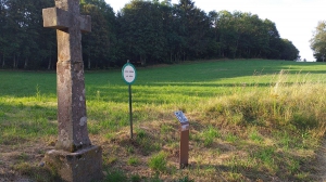
6
Calvaire
Informations complémentaires
kilomètre
4,39
latitude
48.3554
altitude
773
m
longitude
7.06019
7
C05
Informations complémentaires
kilomètre
4,98
latitude
48.3534
altitude
798
m
longitude
7.06006
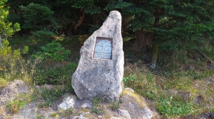
8
photo
Informations complémentaires
kilomètre
5,05
latitude
48.3538
altitude
802
m
longitude
7.05942
9
4 bornes
Informations complémentaires
kilomètre
6,90
latitude
48.3527
altitude
786
m
longitude
7.07607
10
Intersection
Informations complémentaires
kilomètre
8,11
latitude
48.349
altitude
799
m
longitude
7.06192
11
4 Chemins
Informations complémentaires
kilomètre
8,27
latitude
48.3481
altitude
795
m
longitude
7.06064
12
Intersection
Informations complémentaires
kilomètre
8,54
latitude
48.3489
altitude
773
m
longitude
7.05724
13
chute N
Informations complémentaires
kilomètre
10,03
latitude
48.3545
altitude
656
m
longitude
7.0414
Daniel
Note moyenne
Cartes associées
