VD7 de Sainte-Marie de Redon à Saint-Pern
- Mis à jour le 22/09/2021
- Identifiant 1197959
Sélectionner le fond de carte

PLAN IGN

PHOTOS AERIENNES

CARTES IGN MULTI-ECHELLES

TOP 25 IGN

CARTES DES PENTES

PARCELLES CADASTRALES

CARTES OACI

CARTES 1950 IGN

CARTE DE L’ETAT-MAJOR (1820-1866)

Open Street Map
Afficher les points d'intérêt à proximité
Hébergements
Informations
Lieux d'intérêts
Producteurs
Restauration
Services et Commerces
Autre
Echelle
|
durée / niveau
VTC
|
distance
109,3 km
type parcours
|
|||||||||
|
Lieu de départ
35294 SAINTE-MARIE
|
accessibilite
|
|||||||||
|
prestations payantes
Non
|
type(s) de sol
|
|||||||||
Photos & vidéos (1)
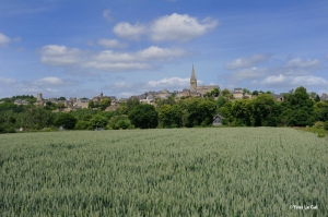
|
description
Landes, pins maritimes, schiste pourpre
Hébergements à proximité
Balisage
VD 7
Conseils aux randonneurs
Itinéraires à proximité
Producteur de la donnée
Ces informations sont issues du système d'information touristique régional.
Elles sont synchronisées dans le cadre du partenariat entre Cirkwi et l'Agence de développement touristique d'Ille-et-Vilaine
Elles sont synchronisées dans le cadre du partenariat entre Cirkwi et l'Agence de développement touristique d'Ille-et-Vilaine
infos parcours (12)
1
Pont du Grand Pas
Informations complémentaires
kilomètre
102,47
latitude
47.6723
altitude
3
m
longitude
-2.03527
2
Chapelle Saint-Fiacre
Informations complémentaires
kilomètre
94,25
latitude
47.7221
altitude
20
m
longitude
-2.01665
3
Landes de Cojoux
Informations complémentaires
kilomètre
134,15
latitude
47.7644
altitude
71
m
longitude
-1.96848
4
Bourg de Saint-Just et maison Nature et mégalithes
Informations complémentaires
kilomètre
134,70
latitude
47.7654
altitude
69
m
longitude
-1.96102
5
Croisement voie verte Messac/Guer
Informations complémentaires
kilomètre
156,33
latitude
47.8987
altitude
63
m
longitude
-2.04836
6
Eglise de Maxent
Informations complémentaires
kilomètre
170,31
latitude
47.9829
altitude
118
m
longitude
-2.03419
7
Plan d'eau de la Chèze
Informations complémentaires
kilomètre
174,05
latitude
48.009
altitude
83
m
longitude
-2.01417
8
Domaine de Careil
Informations complémentaires
kilomètre
185,27
latitude
48.0701
altitude
81
m
longitude
-2.00819
9
Vallon de la Chambre aux Loups
Informations complémentaires
kilomètre
192,13
latitude
48.0933
altitude
85
m
longitude
-2.0622
10
Lavoir d'Iffendic
Informations complémentaires
kilomètre
196,59
latitude
48.1268
altitude
37
m
longitude
-2.03384
11
Château du Lou du Lac
Informations complémentaires
kilomètre
207,56
latitude
48.2001
altitude
79
m
longitude
-1.98316
12
Saint-Pern
Informations complémentaires
kilomètre
218,48
latitude
48.2869
altitude
102
m
longitude
-1.98798
Note moyenne


