
v80 CANAL DES 2 MERS partie1 - 371km
- Mis à jour le 03/04/2017
- Identifiant 159399


|
durée / niveau
Velo route
|
distance
402,1 km
type parcours
Aller Simple
|
|||||||||
|
Lieu de départ
1 qu des sabliers
17200 Royan |
accessibilite
|
|||||||||
|
prestations payantes
Non
|
type(s) de sol
Bitume
Terre |
|||||||||
Hébergements à proximité
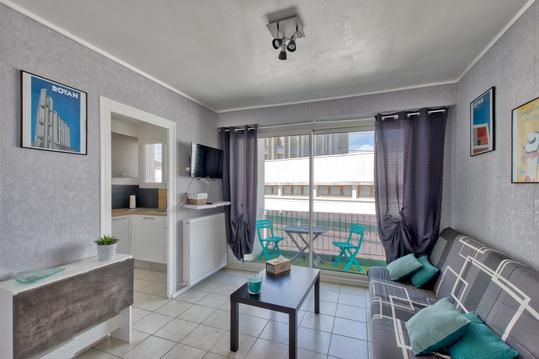
T2 tout équipé (WIFI) en plein centre ville, au ca
IDEALE VACANCES
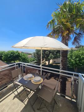
Paisible appart T2 vue sur mer, près de la plage
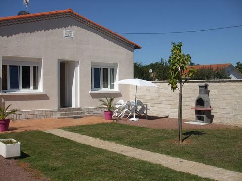
MAISON DE PLAIN PIED, idéal pour famille
Charmante maison 6 personnes proche des plages
Maison bord de lac. Zone piétonnière naturelle.
Grand MH - 40 M2 - 3 Chambres - 2 SdB - Clim
Au coin du bonheur

Points d'interêt (23)
VITREZAY
17150 Saint-Sorlin-de-Conac
BROCHON CAMPING ROSE BLANCHE
17150 Mirambeau
amis marmonteil ludon médoc
33290 Ludon-Médoc
bordeaux le lac
33520 Bruges
PARC DE L'ERMITAGE LORMONT
33310 Lormont
LA BELLE ETOILE
33270 Floirac
LES GUETTEURS
33130 Bègles
gîte citon cénac
contact@gitecitoncenac.com
33360 Cénac
camping bel air
05 56 23 01 90
33670 Sadirac
CAMPINGCHÄTEAU GUITON
33760 Frontenac
bar hotel restaurant sauveterre de guyenne 05/56/71/54/92
33540 Sauveterre-de-Guyenne
CAMPING LE ROUERGUE 33190 LA REOLE
33190 La Réole
BOURDELLES
Accueil national
LE RELAIS DE GARONNE
10 Le Bourg
33190 BOURDELLES
+33 5 56 61 73 64 ou +33 6 81 28 91 28
http://lerelaisdegaronne.com
baillonmichel@orange.fr
33190 Bourdelles
CAMPING MUNICIPAL AU JARDIN
Site WebItinéraire
3,5
2 avis de Google
Terrain de camping
Adresse : Lieu dit Au Jardin, 47180 Meilhan-sur-Garonne
Téléphone :05 53 94 30 04
47180 Meilhan-sur-Garonne
MAOUTENS LA MAISON
47200 FOURQUES-SUR-GARONNE
05 53 93 16 52 +33 6 33 31 82 55
maoutens@gmail.com
47200 FOURQUES SUR GARONNE
HALTE NAUTIQUE 47400 LAGRUERE
47400 Lagruère
damazan camping du lac
05/53/89/74/36 ou 06/27/11/03/57
47160 Saint-Pierre-de-Buzet
CAFE VELO GITE ETAPE
47000 Agen
le parc domaine d'Allot
47550 Boé
CAMPING MUNICIPAL VALENCE D'AGEN
82400 Valence
CAMPING ST NICOLAS DE LA GRAVE
05 63 95 50 02
82210 Saint-Nicolas-de-la-Grave
moulin du bidounet
camping-moissac.com/fr/le-moulin-du-bidounet
82200 Moissac
montech 520 chemin de la pierre 82700 MONTECH 05/63/31/14/29 contact@camping-montech.com
82700 Montech
Michèle
Cartes associées
