
Dans le maquis de la Lance
- Thématique Balade
- Mis à jour le 15/09/2019
- Identifiant 584113
Sélectionner le fond de carte

PLAN IGN

PHOTOS AERIENNES

CARTES IGN MULTI-ECHELLES

TOP 25 IGN

CARTES DES PENTES

PARCELLES CADASTRALES

CARTES OACI

CARTES 1950 IGN

CARTE DE L’ETAT-MAJOR (1820-1866)

Open Street Map
Afficher les points d'intérêt à proximité
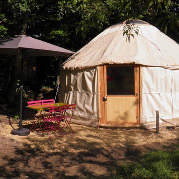
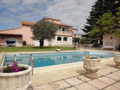
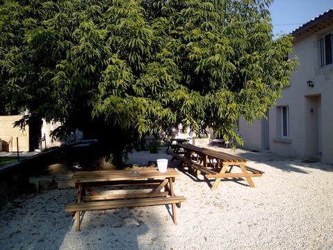
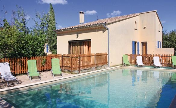
Hébergements
Informations
Lieux d'intérêts
Producteurs
Restauration
Services et Commerces
Autre
Echelle
|
durée / niveau
Rando pédestre
|
distance
10,0 km
type parcours
Boucle
|
|||||||||
|
Lieu de départ
5 pl de l'eglise
26770 Roche-Saint-Secret-Béconne |
accessibilite
|
|||||||||
|
prestations payantes
Non
|
type(s) de sol
Bitume
Terre Rochers |
|||||||||
description
départ de la& Roche ST Secret
Hébergements à proximité

infos parcours (19)
1
Parking de l'Église
Informations complémentaires
kilomètre
0,00
latitude
44.4768
altitude
356
m
longitude
5.02906
2
Parking de l'Église
Informations complémentaires
kilomètre
0,01
latitude
44.4768
altitude
355
m
longitude
5.02895
3
Chemin Rastelet à gauche
Informations complémentaires
kilomètre
0,39
latitude
44.4783
altitude
376
m
longitude
5.03234
4
Chapelle Saint-Secret de la Roche
Informations complémentaires
kilomètre
1,83
latitude
44.4793
altitude
444
m
longitude
5.04787
5
À gauche
Informations complémentaires
kilomètre
1,90
latitude
44.4788
altitude
447
m
longitude
5.04838
6
gr rouge et blanc
Informations complémentaires
kilomètre
2,01
latitude
44.4795
altitude
462
m
longitude
5.04915
7
Croisement sentiers
Informations complémentaires
kilomètre
2,40
latitude
44.4823
altitude
555
m
longitude
5.05216
8
Croisement sentiers
Informations complémentaires
kilomètre
2,43
latitude
44.4826
altitude
561
m
longitude
5.05217
9
Col de la Roche
Informations complémentaires
kilomètre
2,81
latitude
44.4857
altitude
537
m
longitude
5.05167
10
L'Étournelle (poteau balisage)
Informations complémentaires
kilomètre
3,37
latitude
44.4895
altitude
447
m
longitude
5.05544
11
Sur la crête
Informations complémentaires
kilomètre
4,19
latitude
44.495
altitude
465
m
longitude
5.05336
12
Moulin
Informations complémentaires
kilomètre
5,21
latitude
44.497
altitude
397
m
longitude
5.04265
13
fin signalisation
Informations complémentaires
kilomètre
5,65
latitude
44.5002
altitude
390
m
longitude
5.04122
14
Début nouveau tracé du PR (Jaune)
Informations complémentaires
kilomètre
6,18
latitude
44.4983
altitude
375
m
longitude
5.03672
15
Jonction PR-GRP au-dessus de la Tour d'Alencon
Informations complémentaires
kilomètre
6,93
latitude
44.4974
altitude
445
m
longitude
5.02837
16
retrouvez signalisation jaune Rougé
Informations complémentaires
kilomètre
6,95
latitude
44.4972
altitude
441
m
longitude
5.02844
17
Ferme fortifie d'Alençon
Informations complémentaires
kilomètre
8,52
latitude
44.4861
altitude
357
m
longitude
5.0267
18
Ferme fortifie d'Alençon
Informations complémentaires
kilomètre
8,57
latitude
44.4856
altitude
360
m
longitude
5.02609
19
La Condemine 345m - balisage
Informations complémentaires
kilomètre
9,21
latitude
44.4807
altitude
344
m
longitude
5.02711
daniel
Note moyenne
Cartes associées
