
Autour de Pin Bouchain
- Thématique Randonnée
- Mis à jour le 16/10/2019
- Identifiant 597133
Sélectionner le fond de carte

PLAN IGN

PHOTOS AERIENNES

CARTES IGN MULTI-ECHELLES

TOP 25 IGN

CARTES DES PENTES

PARCELLES CADASTRALES

CARTES OACI

CARTES 1950 IGN

CARTE DE L’ETAT-MAJOR (1820-1866)

Open Street Map
Afficher les points d'intérêt à proximité
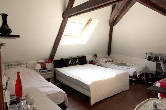
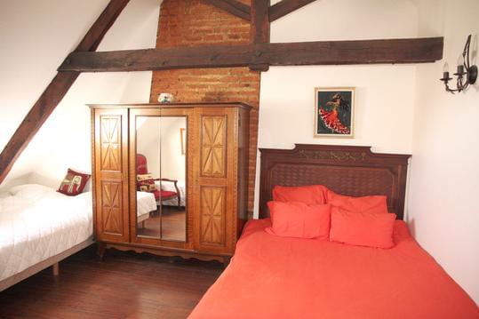
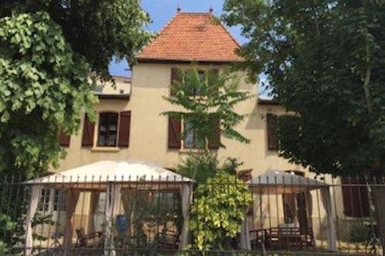
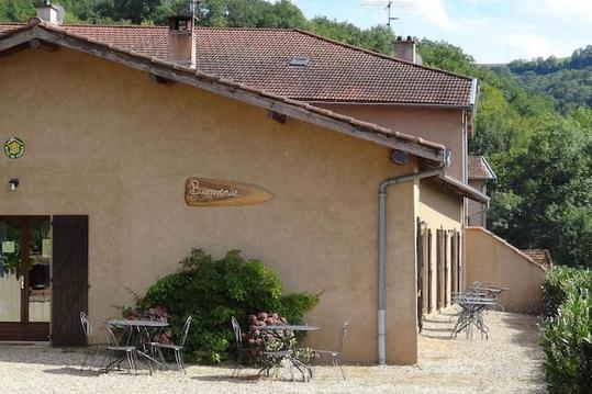
Hébergements
Informations
Lieux d'intérêts
Producteurs
Restauration
Services et Commerces
Autre
Echelle
|
durée / niveau
Rando pédestre
|
distance
17,6 km
type parcours
|
|||||||||
|
Lieu de départ
69170 Les Sauvages
|
accessibilite
|
|||||||||
|
prestations payantes
Non
|
type(s) de sol
Bitume
Terre |
|||||||||
Hébergements à proximité

infos parcours (16)
1
Parking de La Chapelle près du Pin Bouchain
Informations complémentaires
kilomètre
0,00
latitude
45.9164
altitude
767
m
longitude
4.34644
2
Parking de La Chapelle près du Pin Bouchain
Informations complémentaires
kilomètre
0,01
latitude
45.9164
altitude
767
m
longitude
4.34643
3
Pylône de télécommunications
Informations complémentaires
kilomètre
0,57
latitude
45.9204
altitude
799
m
longitude
4.35025
4
Carrefour des 3 chemins
Informations complémentaires
kilomètre
2,70
latitude
45.9374
altitude
560
m
longitude
4.35526
5
D8
Informations complémentaires
kilomètre
3,56
latitude
45.9433
altitude
505
m
longitude
4.35429
6
D8
Informations complémentaires
kilomètre
4,94
latitude
45.9481
altitude
476
m
longitude
4.34779
7
Château de Rochefort
Informations complémentaires
kilomètre
6,20
latitude
45.9473
altitude
586
m
longitude
4.33641
8
Le Pilon
Informations complémentaires
kilomètre
7,78
latitude
45.948
altitude
598
m
longitude
4.32191
9
Carrefour du Pilon
Informations complémentaires
kilomètre
7,87
latitude
45.9473
altitude
603
m
longitude
4.32164
10
2ème chemin après la maison
Informations complémentaires
kilomètre
8,39
latitude
45.9435
altitude
609
m
longitude
4.3189
11
La Forêt
Informations complémentaires
kilomètre
9,47
latitude
45.9419
altitude
543
m
longitude
4.30916
12
Le Chassin
Informations complémentaires
kilomètre
11,15
latitude
45.9282
altitude
642
m
longitude
4.31043
13
Les Arrières
Informations complémentaires
kilomètre
12,30
latitude
45.9299
altitude
637
m
longitude
4.3206
14
Vers Machezal (panneau sur Napoléon)
Informations complémentaires
kilomètre
13,57
latitude
45.9233
altitude
685
m
longitude
4.31289
15
N7
Informations complémentaires
kilomètre
14,79
latitude
45.9181
altitude
737
m
longitude
4.32454
16
N7
Informations complémentaires
kilomètre
17,43
latitude
45.9155
altitude
761
m
longitude
4.34498
Michel
Note moyenne
Cartes associées
