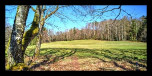
Harreberg-Hohwalsch-Traubachthal
- Mis à jour le 23/03/2020
- Identifiant 701379
Sélectionner le fond de carte

PLAN IGN

PHOTOS AERIENNES

CARTES IGN MULTI-ECHELLES

TOP 25 IGN

CARTES DES PENTES

PARCELLES CADASTRALES

CARTES OACI

CARTES 1950 IGN

CARTE DE L’ETAT-MAJOR (1820-1866)

Open Street Map
Afficher les points d'intérêt à proximité
Hébergements
Informations
Lieux d'intérêts
Producteurs
Restauration
Services et Commerces
Autre
Echelle
|
durée / niveau
Rando pédestre
|
distance
15,9 km
type parcours
Boucle
|
|||||||||
|
Lieu de départ
1 r du coteau
57870 Harreberg |
accessibilite
|
|||||||||
|
prestations payantes
Non
|
type(s) de sol
Graviers
Sable Terre Herbe |
|||||||||
|
Mots clés
Harreberg, Hohwalsch
|
||||||||||
Photos & vidéos (1)
|
description
Départ de Harreberg, Croix du Hengstbourg, Croix de Beimbach-Cimetière gallo-romain, Hohwalsch, route forestière de la Carrière, Route forestière du Traubachthal