Tréguier - Beg-Ar-Vilin (Plougrescant)
- Mis à jour le 11/10/2021
- Identifiant 1408981
Sélectionner le fond de carte

PLAN IGN

PHOTOS AERIENNES

CARTES IGN MULTI-ECHELLES

TOP 25 IGN

CARTES DES PENTES

PARCELLES CADASTRALES

CARTES OACI

CARTES 1950 IGN

CARTE DE L’ETAT-MAJOR (1820-1866)

Open Street Map
Afficher les points d'intérêt à proximité
Hébergements
Informations
Lieux d'intérêts
Producteurs
Restauration
Services et Commerces
Autre
Echelle
|
durée / niveau
Rando pédestre
|
distance
15,4 km
type parcours
Aller Simple
|
|||||||||
|
Lieu de départ
22220 Tréguier
|
accessibilite
|
|||||||||
|
prestations payantes
Non
|
type(s) de sol
Bitume
Graviers Sable Terre Herbe Rochers |
|||||||||
description
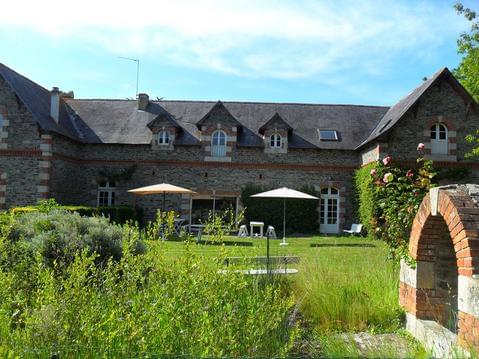
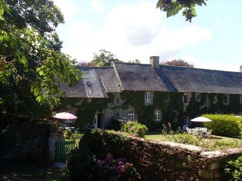
Ce parcours au départ du port de Tréguier suit principalement le GR34 et quelques fois est abandonné pour le sentier des douaniers ou le GR 34 bis. L'arrivée est au camping de Beg-Ar-Vilin où il est possible de dormir une seule nuit.
Hébergements à proximité
infos parcours (24)
1
Lost GPS
31:08:12
Informations complémentaires
kilomètre
8,09
latitude
48.8265
altitude
40
m
longitude
-3.20467
2
Regained GPS
44:25:00
Informations complémentaires
kilomètre
13,00
latitude
48.8452
altitude
7
m
longitude
-3.21209
3
Lost GPS
44:24:56
Informations complémentaires
kilomètre
13,00
latitude
48.8452
altitude
7
m
longitude
-3.2121
4
Regained GPS
42:14:51
Informations complémentaires
kilomètre
18,58
latitude
48.8392
altitude
17
m
longitude
-3.21441
5
Lost GPS
42:14:48
Informations complémentaires
kilomètre
18,58
latitude
48.8392
altitude
17
m
longitude
-3.21442
6
Regained GPS
37:43:40
Informations complémentaires
kilomètre
20,57
latitude
48.838
altitude
5
m
longitude
-3.20651
7
Lost GPS
37:43:36
Informations complémentaires
kilomètre
20,57
latitude
48.838
altitude
5
m
longitude
-3.2065
8
Regained GPS
34:26:36
Informations complémentaires
kilomètre
21,64
latitude
48.8302
altitude
7
m
longitude
-3.20384
9
Lost GPS
34:26:32
Informations complémentaires
kilomètre
21,64
latitude
48.8302
altitude
7
m
longitude
-3.20384
10
Regained GPS
33:20:52
Informations complémentaires
kilomètre
21,97
latitude
48.8284
altitude
27
m
longitude
-3.20639
11
Lost GPS
33:20:48
Informations complémentaires
kilomètre
21,97
latitude
48.8284
altitude
28
m
longitude
-3.20642
12
Regained GPS
31:08:15
Informations complémentaires
kilomètre
22,75
latitude
48.8265
altitude
40
m
longitude
-3.20468
13
Start
-3.230822,48.787472
Informations complémentaires
kilomètre
30,84
latitude
48.7875
altitude
35
m
longitude
-3.23082
14
Regained GPS
30:03:46
Informations complémentaires
kilomètre
22,97
latitude
48.8248
altitude
19
m
longitude
-3.20482
15
Lost GPS
30:03:43
Informations complémentaires
kilomètre
22,97
latitude
48.8247
altitude
17
m
longitude
-3.20482
16
Regained GPS
17:45:26
Informations complémentaires
kilomètre
24,13
latitude
48.8158
altitude
4
m
longitude
-3.20641
17
Lost GPS
17:45:23
Informations complémentaires
kilomètre
24,13
latitude
48.8158
altitude
4
m
longitude
-3.20641
18
Regained GPS
14:28:36
Informations complémentaires
kilomètre
25,24
latitude
48.8076
altitude
3
m
longitude
-3.21261
19
Lost GPS
14:28:25
Informations complémentaires
kilomètre
25,25
latitude
48.8076
altitude
4
m
longitude
-3.21273
20
Regained GPS
12:17:09
Informations complémentaires
kilomètre
25,69
latitude
48.8043
altitude
3
m
longitude
-3.21628
21
Lost GPS
12:17:06
Informations complémentaires
kilomètre
25,70
latitude
48.8044
altitude
6
m
longitude
-3.21628
22
Regained GPS
01:06:25
Informations complémentaires
kilomètre
30,35
latitude
48.7885
altitude
6
m
longitude
-3.22492
23
Lost GPS
01:06:19
Informations complémentaires
kilomètre
30,35
latitude
48.7886
altitude
6
m
longitude
-3.22493
24
End
-3.207469,48.847479
Informations complémentaires
kilomètre
17,20
latitude
48.8475
altitude
6
m
longitude
-3.20747
Note moyenne


