
Chateau de Brancion
- Thématique Randonnée
- Mis à jour le 20/06/2022
- Identifiant 1730428
Sélectionner le fond de carte

PLAN IGN

PHOTOS AERIENNES

CARTES IGN MULTI-ECHELLES

TOP 25 IGN

CARTES DES PENTES

PARCELLES CADASTRALES

CARTES OACI

CARTES 1950 IGN

CARTE DE L’ETAT-MAJOR (1820-1866)

Open Street Map
Afficher les points d'intérêt à proximité
Hébergements
Informations
Lieux d'intérêts
Producteurs
Restauration
Services et Commerces
Autre
Echelle
|
durée / niveau
Rando pédestre
|
distance
29,3 km
type parcours
|
|||||||||
|
Lieu de départ
71240 Mancey
|
accessibilite
|
|||||||||
|
prestations payantes
Non
|
type(s) de sol
Graviers
Terre Herbe Rochers |
|||||||||
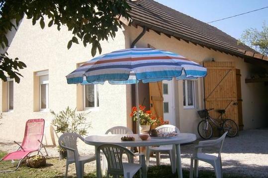
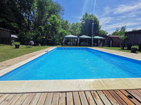
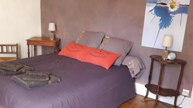
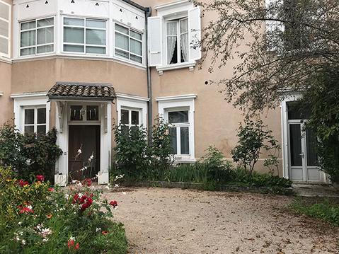
Hébergements à proximité

infos parcours (21)
1
Village du Château de Brancion
Informations complémentaires
kilomètre
10,46
latitude
46.5481
altitude
368
m
longitude
4.79546
2
Parking de l'auberge du Col des Chèvres
Informations complémentaires
kilomètre
0,00
latitude
46.5749
altitude
251
m
longitude
4.8446
3
Route, à gauche
Informations complémentaires
kilomètre
18,30
latitude
46.5751
altitude
261
m
longitude
4.84124
4
Chemin en gravier en face
Informations complémentaires
kilomètre
40,96
latitude
46.577
altitude
284
m
longitude
4.83505
5
Au croisement, à droite entre les 2 maisons
Informations complémentaires
kilomètre
41,11
latitude
46.5767
altitude
296
m
longitude
4.83312
6
À droite jusqu'à l'église de Mancey
Informations complémentaires
kilomètre
41,40
latitude
46.5767
altitude
321
m
longitude
4.8299
7
Circuit de moto-cross, à droite
Informations complémentaires
kilomètre
41,84
latitude
46.5733
altitude
359
m
longitude
4.82757
8
Chemin escarpé à gauche
Informations complémentaires
kilomètre
42,13
latitude
46.5711
altitude
330
m
longitude
4.828
9
Lavoir
Informations complémentaires
kilomètre
42,75
latitude
46.5678
altitude
326
m
longitude
4.82306
10
Petit chemin à droite
Informations complémentaires
kilomètre
43,61
latitude
46.5637
altitude
323
m
longitude
4.82246
11
Prendre le chemin à droite
Informations complémentaires
kilomètre
47,21
latitude
46.5447
altitude
385
m
longitude
4.80326
12
Parking de l'auberge du Col des Chèvres
Informations complémentaires
kilomètre
58,69
latitude
46.5749
altitude
251
m
longitude
4.84461
13
Sentier à gauche avant la route
Informations complémentaires
kilomètre
48,73
latitude
46.5495
altitude
291
m
longitude
4.79828
14
Grotte du Four de la Baume
Informations complémentaires
kilomètre
49,07
latitude
46.5471
altitude
332
m
longitude
4.80074
15
Parking du château
Informations complémentaires
kilomètre
49,45
latitude
46.5443
altitude
363
m
longitude
4.79995
16
Carrefour de quatre chemins
Informations complémentaires
kilomètre
49,76
latitude
46.5447
altitude
384
m
longitude
4.80287
17
Roche de la Table Ronde
Informations complémentaires
kilomètre
53,41
latitude
46.5731
altitude
450
m
longitude
4.81559
18
Intersection avec panneau en bois "Étrigny"
Informations complémentaires
kilomètre
53,72
latitude
46.5746
altitude
451
m
longitude
4.81789
19
Roche d'Aujoux
Informations complémentaires
kilomètre
54,45
latitude
46.5803
altitude
484
m
longitude
4.81778
20
Parking, à gauche sur le Chemin des Moines
Informations complémentaires
kilomètre
56,09
latitude
46.5903
altitude
447
m
longitude
4.83114
21
Intersection, à gauche
Informations complémentaires
kilomètre
57,38
latitude
46.5838
altitude
324
m
longitude
4.83878
Joel
Note moyenne
Cartes associées
