
Les 3 Ports
- Thématique Balade
- Mis à jour le 27/11/2022
- Identifiant 1762144
Sélectionner le fond de carte

PLAN IGN

PHOTOS AERIENNES

CARTES IGN MULTI-ECHELLES

TOP 25 IGN

CARTES DES PENTES

PARCELLES CADASTRALES

CARTES OACI

CARTES 1950 IGN

CARTE DE L’ETAT-MAJOR (1820-1866)

Open Street Map
Afficher les points d'intérêt à proximité
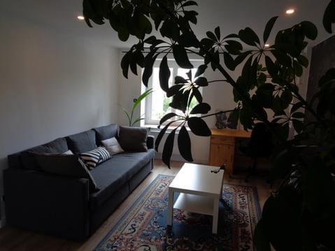
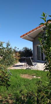
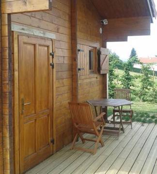
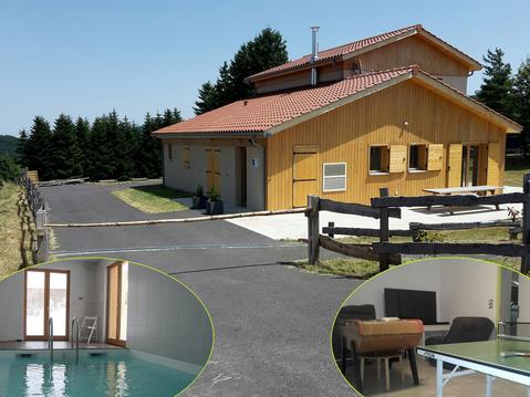
Hébergements
Informations
Lieux d'intérêts
Producteurs
Restauration
Services et Commerces
Autre
Echelle
|
durée / niveau
Rando pédestre
|
distance
16,1 km
type parcours
|
|||||||||
|
Lieu de départ
42160 Andrézieux-Bouthéon
|
accessibilite
|
|||||||||
|
prestations payantes
Non
|
type(s) de sol
Bitume
Graviers Terre |
|||||||||
Hébergements à proximité

infos parcours (19)
1
Rue de la marine
Informations complémentaires
kilomètre
8,32
latitude
45.5051
altitude
368
m
longitude
4.2572
2
Château de Bouthéon
Informations complémentaires
kilomètre
0,01
latitude
45.5444
altitude
395
m
longitude
4.26575
3
Côte duraille en chemin
Informations complémentaires
kilomètre
15,00
latitude
45.5399
altitude
361
m
longitude
4.26537
4
Carrefour après station d'épuration
Informations complémentaires
kilomètre
18,57
latitude
45.5371
altitude
362
m
longitude
4.25196
5
Virage à gauche, panneau randonnée des 3 ports
Informations complémentaires
kilomètre
19,38
latitude
45.5298
altitude
364
m
longitude
4.25176
6
Passage sur le pont
Informations complémentaires
kilomètre
19,76
latitude
45.5301
altitude
360
m
longitude
4.24885
7
Panneau randonnée des 3 ports
Informations complémentaires
kilomètre
20,37
latitude
45.5264
altitude
364
m
longitude
4.24547
8
Passage sous pont
Informations complémentaires
kilomètre
21,47
latitude
45.5166
altitude
364
m
longitude
4.24768
9
Sortie du pont première à droite
Informations complémentaires
kilomètre
23,46
latitude
45.5017
altitude
371
m
longitude
4.25783
10
Passage sur le pont
Informations complémentaires
kilomètre
23,68
latitude
45.5033
altitude
374
m
longitude
4.26004
11
Château de Bouthéon
Informations complémentaires
kilomètre
32,29
latitude
45.5444
altitude
395
m
longitude
4.26574
12
Passage sous pont
Informations complémentaires
kilomètre
25,48
latitude
45.5172
altitude
363
m
longitude
4.25003
13
Panneau randonnée des 3 ports
Informations complémentaires
kilomètre
26,17
latitude
45.5227
altitude
367
m
longitude
4.24996
14
Rue Jules Riboulin
Informations complémentaires
kilomètre
26,54
latitude
45.5259
altitude
365
m
longitude
4.25068
15
Passage sous pont
Informations complémentaires
kilomètre
26,98
latitude
45.5298
altitude
361
m
longitude
4.25047
16
Arrivée au parc de loisir
Informations complémentaires
kilomètre
28,25
latitude
45.5394
altitude
361
m
longitude
4.24445
17
Bifurquer pour rejoindre le pont en métal
Informations complémentaires
kilomètre
30,15
latitude
45.5509
altitude
358
m
longitude
4.25833
18
Pont en bois (danger)
Informations complémentaires
kilomètre
31,07
latitude
45.5526
altitude
356
m
longitude
4.26754
19
Monticule
Informations complémentaires
kilomètre
31,13
latitude
45.5521
altitude
361
m
longitude
4.26768
Régis
Note moyenne
Cartes associées
