
Soudon - Crêt St Martin - Crêt du pont
- Thématique Randonnée
- Mis à jour le 08/12/2022
- Identifiant 1946000
Sélectionner le fond de carte

PLAN IGN

PHOTOS AERIENNES

CARTES IGN MULTI-ECHELLES

TOP 25 IGN

CARTES DES PENTES

PARCELLES CADASTRALES

CARTES OACI

CARTES 1950 IGN

CARTE DE L’ETAT-MAJOR (1820-1866)

Open Street Map
Afficher les points d'intérêt à proximité
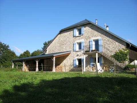
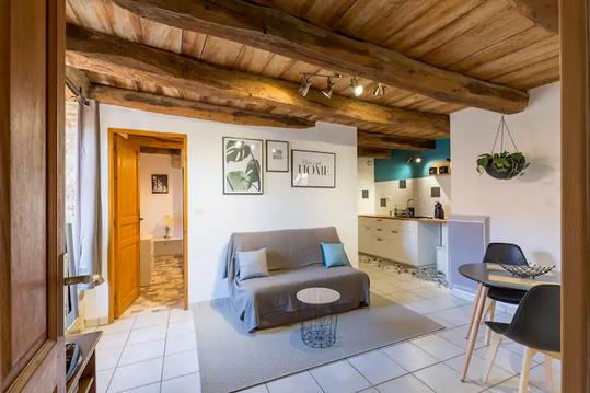
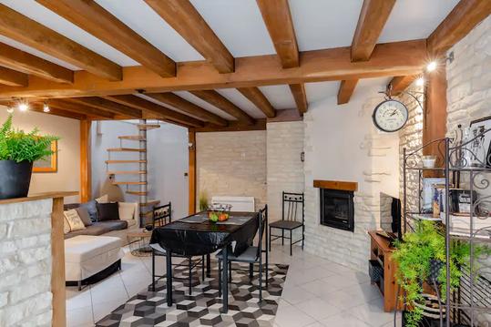
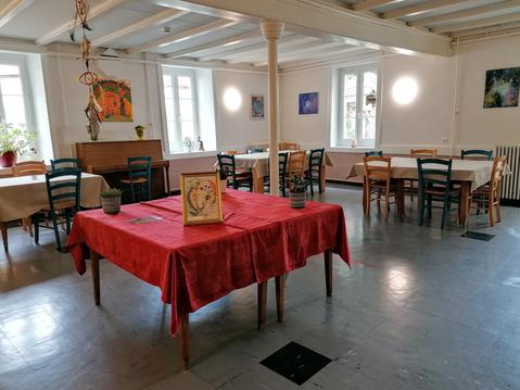
Hébergements
Informations
Lieux d'intérêts
Producteurs
Restauration
Services et Commerces
Autre
Echelle
|
durée / niveau
Rando pédestre
|
distance
19,2 km
type parcours
Boucle
|
|||||||||
|
Lieu de départ
01150 Souclin
|
accessibilite
|
|||||||||
|
prestations payantes
Non
|
type(s) de sol
Bitume
Terre Herbe |
|||||||||
Hébergements à proximité

infos parcours (15)
1
Croix en bois
Informations complémentaires
kilomètre
0,67
latitude
45.8723
altitude
578
m
longitude
5.4242
2
Chemin de Merdanson
Informations complémentaires
kilomètre
1,47
latitude
45.8791
altitude
700
m
longitude
5.42587
3
Chemin de débardage
Informations complémentaires
kilomètre
2,30
latitude
45.8853
altitude
753
m
longitude
5.43085
4
Bifurcation après un cours d'eau
Informations complémentaires
kilomètre
3,44
latitude
45.883
altitude
685
m
longitude
5.44124
5
Bifurcation après hameau
Informations complémentaires
kilomètre
6,10
latitude
45.9016
altitude
473
m
longitude
5.4266
6
Entrée de Cleyzieu
Informations complémentaires
kilomètre
7,00
latitude
45.9069
altitude
570
m
longitude
5.42768
7
Sortie de Cleyzieu
Informations complémentaires
kilomètre
7,86
latitude
45.9044
altitude
622
m
longitude
5.43586
8
Chemin
Informations complémentaires
kilomètre
8,56
latitude
45.9094
altitude
731
m
longitude
5.43388
9
Fin du champ
Informations complémentaires
kilomètre
10,93
latitude
45.8932
altitude
822
m
longitude
5.44888
10
Point de vue
Informations complémentaires
kilomètre
12,68
latitude
45.8814
altitude
879
m
longitude
5.44659
11
Clairière
Informations complémentaires
kilomètre
13,65
latitude
45.8754
altitude
965
m
longitude
5.4534
12
Crêt de Pont
Informations complémentaires
kilomètre
14,29
latitude
45.877
altitude
1048
m
longitude
5.45648
13
Bifurcation après un champ
Informations complémentaires
kilomètre
16,34
latitude
45.8766
altitude
840
m
longitude
5.4457
14
Arrivée sur une route
Informations complémentaires
kilomètre
17,71
latitude
45.8712
altitude
693
m
longitude
5.43333
15
D99
Informations complémentaires
kilomètre
18,50
latitude
45.8691
altitude
583
m
longitude
5.4295
Georges
Note moyenne
Cartes associées
