Plougastel/Penn ar Stêr - Daoulas
- Thématique Mer, océan
- Mis à jour le 16/08/2023
- Identifiant 2014411
Sélectionner le fond de carte

PLAN IGN

PHOTOS AERIENNES

CARTES IGN MULTI-ECHELLES

TOP 25 IGN

CARTES DES PENTES

PARCELLES CADASTRALES

CARTES OACI

CARTES 1950 IGN

CARTE DE L’ETAT-MAJOR (1820-1866)

Open Street Map
Afficher les points d'intérêt à proximité
Hébergements
Informations
Lieux d'intérêts
Producteurs
Restauration
Services et Commerces
Autre
Echelle
|
durée / niveau
Rando pédestre
|
distance
24,3 km
type parcours
Aller Simple
|
|||||||||
|
Lieu de départ
29470 Plougastel-Daoulas
|
accessibilite
|
|||||||||
|
prestations payantes
Non
|
type(s) de sol
Bitume
Graviers Terre Herbe |
|||||||||
description
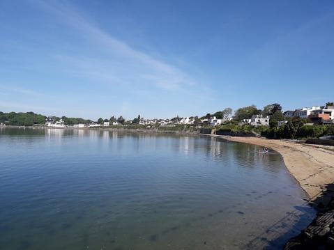
Départ du moulin de Penn ar Ster à Plougastel-Daoulas, Suivre le sentier jusqu'à la pointe de Doubidy/Rozebad.
Remonter la baie de Daoulas alternativement par des sentiers et des petites routes.
Le GR34 est rejoint entre le Pedel et Penfoul, le suivre jusqu'à Daoulas.
Remonter la baie de Daoulas alternativement par des sentiers et des petites routes.
Le GR34 est rejoint entre le Pedel et Penfoul, le suivre jusqu'à Daoulas.
Hébergements à proximité
infos parcours (20)
1
Lost GPS
45:31:23
Informations complémentaires
kilomètre
12,00
latitude
48.3583
altitude
24
m
longitude
-4.35321
2
Regained GPS
67:43:09
Informations complémentaires
kilomètre
20,63
latitude
48.362
altitude
27
m
longitude
-4.26492
3
Lost GPS
67:43:05
Informations complémentaires
kilomètre
20,63
latitude
48.362
altitude
27
m
longitude
-4.26493
4
Regained GPS
55:30:16
Informations complémentaires
kilomètre
33,03
latitude
48.3618
altitude
7
m
longitude
-4.31681
5
Lost GPS
55:30:13
Informations complémentaires
kilomètre
33,03
latitude
48.3618
altitude
7
m
longitude
-4.31682
6
Regained GPS
49:59:05
Informations complémentaires
kilomètre
34,95
latitude
48.3598
altitude
35
m
longitude
-4.33304
7
Lost GPS
49:59:02
Informations complémentaires
kilomètre
34,95
latitude
48.3598
altitude
35
m
longitude
-4.33306
8
Regained GPS
48:49:03
Informations complémentaires
kilomètre
35,55
latitude
48.3586
altitude
5
m
longitude
-4.34037
9
Lost GPS
48:49:00
Informations complémentaires
kilomètre
35,55
latitude
48.3586
altitude
5
m
longitude
-4.34037
10
Regained GPS
45:31:26
Informations complémentaires
kilomètre
36,60
latitude
48.3583
altitude
24
m
longitude
-4.3532
11
Start
-4.390541,48.342082
Informations complémentaires
kilomètre
48,59
latitude
48.3421
altitude
4
m
longitude
-4.39054
12
Regained GPS
20:04:17
Informations complémentaires
kilomètre
41,75
latitude
48.3261
altitude
18
m
longitude
-4.38503
13
Lost GPS
20:04:14
Informations complémentaires
kilomètre
41,75
latitude
48.3261
altitude
18
m
longitude
-4.38506
14
Resume-3
68:53:38
Informations complémentaires
kilomètre
27,96
latitude
48.362
altitude
27
m
longitude
-4.26489
15
Pause-3
67:43:39
Informations complémentaires
kilomètre
27,97
latitude
48.362
altitude
27
m
longitude
-4.26492
16
Resume-2
44:25:41
Informations complémentaires
kilomètre
36,94
latitude
48.3558
altitude
27
m
longitude
-4.35423
17
Pause-2
44:24:35
Informations complémentaires
kilomètre
36,94
latitude
48.3558
altitude
27
m
longitude
-4.35423
18
Resume-1
44:24:30
Informations complémentaires
kilomètre
36,94
latitude
48.3558
altitude
27
m
longitude
-4.35424
19
Pause-1
34:26:30
Informations complémentaires
kilomètre
36,94
latitude
48.3558
altitude
27
m
longitude
-4.35424
20
End
-4.259591,48.362896
Informations complémentaires
kilomètre
27,10
latitude
48.3629
altitude
7
m
longitude
-4.25959
Note moyenne


