Petit Piquey - GT - RD - Pointe aux Chevaux
- Thématique Randonnée
- Mis à jour le 12/06/2023
- Identifiant 2115226
Sélectionner le fond de carte

PLAN IGN

PHOTOS AERIENNES

CARTES IGN MULTI-ECHELLES

TOP 25 IGN

CARTES DES PENTES

PARCELLES CADASTRALES

CARTES OACI

CARTES 1950 IGN

CARTE DE L’ETAT-MAJOR (1820-1866)

Open Street Map
Afficher les points d'intérêt à proximité
Hébergements
Informations
Lieux d'intérêts
Producteurs
Restauration
Services et Commerces
Autre
Echelle
|
durée / niveau
Rando pédestre
|
distance
10,5 km
type parcours
Boucle
|
|||||||||
|
Lieu de départ
33950 Lège-Cap-Ferret
|
accessibilite
|
|||||||||
|
prestations payantes
Non
|
type(s) de sol
Sable
Terre |
|||||||||
Photos & vidéos (1)

|
description
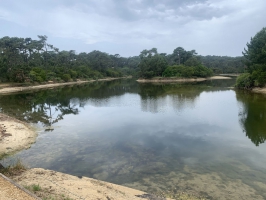
De la Pointe aux chevaux au Réservoir de Piraillan
Hébergements à proximité
infos parcours (11)
1
Informations complémentaires
kilomètre
0,01
latitude
44.7184
altitude
10
m
longitude
-1.20542
2
Informations complémentaires
kilomètre
0,76
latitude
44.7188
altitude
3
m
longitude
-1.21373
3
Informations complémentaires
kilomètre
2,14
latitude
44.7214
altitude
4
m
longitude
-1.22846
4
Informations complémentaires
kilomètre
4,91
latitude
44.7151
altitude
18
m
longitude
-1.24943
5
Informations complémentaires
kilomètre
5,44
latitude
44.7155
altitude
3
m
longitude
-1.24332
6
Informations complémentaires
kilomètre
6,75
latitude
44.7125
altitude
3
m
longitude
-1.23266
7
Informations complémentaires
kilomètre
7,94
latitude
44.7105
altitude
2
m
longitude
-1.22261
8
Informations complémentaires
kilomètre
8,62
latitude
44.7128
altitude
11
m
longitude
-1.21549
9
Informations complémentaires
kilomètre
8,70
latitude
44.7133
altitude
9
m
longitude
-1.21483
10
Informations complémentaires
kilomètre
9,27
latitude
44.7158
altitude
3
m
longitude
-1.21002
11
Informations complémentaires
kilomètre
20,93
latitude
44.7183
altitude
6
m
longitude
-1.20509


