
Circuit des Fontaines
- Mis à jour le 23/12/2024
- Identifiant 2144988
Sélectionner le fond de carte

PLAN IGN

PHOTOS AERIENNES

CARTES IGN MULTI-ECHELLES

TOP 25 IGN

CARTES DES PENTES

PARCELLES CADASTRALES

CARTES OACI

CARTES 1950 IGN

CARTE DE L’ETAT-MAJOR (1820-1866)

Open Street Map
Afficher les points d'intérêt à proximité
Hébergements
Informations
Lieux d'intérêts
Producteurs
Restauration
Services et Commerces
Autre
Echelle
|
durée / niveau
Rando pédestre
|
distance
1,2 km
type parcours
|
|||||||||
|
Lieu de départ
1 Rue des Coteaux
85590 LES EPESSES |
accessibilite
|
|||||||||
|
prestations payantes
Non
|
type(s) de sol
|
|||||||||
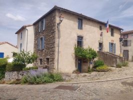
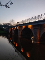
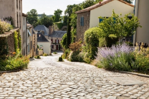
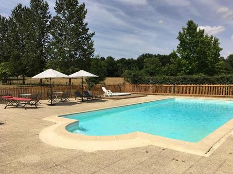
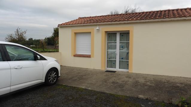
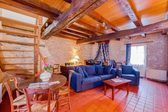
Photos & vidéos (3)
|
|
|
description
Découvrez la cité aux 60 fontaines sous un nouvel angle, avec des bornes interactives qui retracent l'histoire de Mallièvre.
Hébergements à proximité

Points d'interêt (9)
A
Voir la fiche du point d'intéret »
1 : Bienvenue à Mallièvre
Autres informations
Informations complémentaires
4 Chemin de la Teinturerie
85590 MALLIÈVRE
85590 MALLIÈVRE
kilomètre
0,17
latitude
46.9109
altitude
127
m
longitude
-0.865619
B
Voir la fiche du point d'intéret »
2 : La mémoire de l'eau
Autres informations
Informations complémentaires
2 Rue du Pavé
85590 MALLIÈVRE
85590 MALLIÈVRE
kilomètre
0,26
latitude
46.9111
altitude
142
m
longitude
-0.864626
C
Voir la fiche du point d'intéret »
3 : La vie au village en 1943
Autres informations
Informations complémentaires
15 Rue du Château
85590 MALLIÈVRE
85590 MALLIÈVRE
kilomètre
0,31
latitude
46.911
altitude
147
m
longitude
-0.864009
D
Voir la fiche du point d'intéret »
4 : L'habitat à Mallièvre
Autres informations
Informations complémentaires
3 Rue du Puits
85590 MALLIÈVRE
85590 MALLIÈVRE
kilomètre
0,40
latitude
46.9116
altitude
150
m
longitude
-0.864009
E
Voir la fiche du point d'intéret »
5 : L'origine du nom Mallièvre
Autres informations
Informations complémentaires
11 Rue de la Poterne
85590 MALLIÈVRE
85590 MALLIÈVRE
kilomètre
0,63
latitude
46.9124
altitude
134
m
longitude
-0.865157
F
Voir la fiche du point d'intéret »
6 : La légende de Génovette
Autres informations
Informations complémentaires
4 Rue du Moulin Baubry
85590 MALLIÈVRE
85590 MALLIÈVRE
kilomètre
0,86
latitude
46.9119
altitude
131
m
longitude
-0.867646
G
Voir la fiche du point d'intéret »
7 : La Sèvre Nantaise
Autres informations
Informations complémentaires
9 Le Moulin Baubry
85590 MALLIÈVRE
85590 MALLIÈVRE
kilomètre
0,99
latitude
46.9112
altitude
130
m
longitude
-0.866697
H
Voir la fiche du point d'intéret »
Autre point d'intéret : Jardin Marie-Eulalie
Point d'intérêt naturel
Informations complémentaires
5 Rue de la Garenne
85590 MALLIÈVRE
85590 MALLIÈVRE
kilomètre
2,13
latitude
46.9104
altitude
151
m
longitude
-0.863891
I
Voir la fiche du point d'intéret »
Jardin Marie-Eulalie
Point d'intérêt naturel
Informations complémentaires
5 Rue de la Garenne
85590 MALLIÈVRE
85590 MALLIÈVRE
kilomètre
2,13
latitude
46.9104
altitude
151
m
longitude
-0.86394
Arnaud
Note moyenne
Cartes associées
