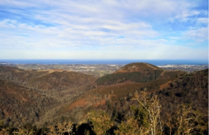
L'Aritzmendi en boucle depuis Bera de Bidassoa.
- Thématique Montagne
- Mis à jour le 01/09/2023
- Identifiant 2216352
Sélectionner le fond de carte

PLAN IGN

PHOTOS AERIENNES

CARTES IGN MULTI-ECHELLES

TOP 25 IGN

CARTES DES PENTES

PARCELLES CADASTRALES

CARTES OACI

CARTES 1950 IGN

CARTE DE L’ETAT-MAJOR (1820-1866)

Open Street Map
Afficher les points d'intérêt à proximité
Hébergements
Informations
Lieux d'intérêts
Producteurs
Restauration
Services et Commerces
Autre
Echelle
|
durée / niveau
Rando pédestre
|
distance
11,6 km
type parcours
Boucle
|
|||||||||
|
Lieu de départ
Hors France
|
accessibilite
|
|||||||||
|
prestations payantes
Non
|
type(s) de sol
Bitume
Graviers Terre Herbe |
|||||||||
Photos & vidéos (1)
|
Hébergements à proximité
infos parcours (13)
1
Parking, le long du ruisseau Olazar.
Informations complémentaires
kilomètre
0,00
latitude
43.2816
altitude
89
m
longitude
-1.67732
2
Route à gauche
Informations complémentaires
kilomètre
0,79
latitude
43.2823
altitude
100
m
longitude
-1.66805
3
Croisement, à droite et de suite à gauche.
Informations complémentaires
kilomètre
2,54
latitude
43.2924
altitude
212
m
longitude
-1.66784
4
Piste à droite.
Informations complémentaires
kilomètre
2,75
latitude
43.2938
altitude
277
m
longitude
-1.66781
5
Col
Informations complémentaires
kilomètre
3,47
latitude
43.2993
altitude
300
m
longitude
-1.66482
6
Pancartes, à gauche
Informations complémentaires
kilomètre
4,31
latitude
43.3003
altitude
337
m
longitude
-1.6564
7
Embranchement / A : tout droit - R : à droite
Informations complémentaires
kilomètre
5,05
latitude
43.3036
altitude
392
m
longitude
-1.6559
8
Clôture, à gauche toute
Informations complémentaires
kilomètre
7,13
latitude
43.3062
altitude
259
m
longitude
-1.66559
9
Croisement, à gauche
Informations complémentaires
kilomètre
7,51
latitude
43.3046
altitude
224
m
longitude
-1.66782
10
Palombières de Txarrantxarri
Informations complémentaires
kilomètre
8,70
latitude
43.2994
altitude
291
m
longitude
-1.67464
11
À droite.
Informations complémentaires
kilomètre
9,35
latitude
43.2955
altitude
188
m
longitude
-1.67781
12
Route Ibardin - Bera
Informations complémentaires
kilomètre
10,95
latitude
43.2858
altitude
101
m
longitude
-1.6794
13
Parking sur la PR-NA 16
Informations complémentaires
kilomètre
23,16
latitude
43.2816
altitude
89
m
longitude
-1.67744


