
LES GORGES DE LA CANCHES ROUSSILLON EN MORVAN
- Thématique Randonnée
- Mis à jour le 16/01/2025
- Identifiant 2670303
Sélectionner le fond de carte

PLAN IGN

PHOTOS AERIENNES

CARTES IGN MULTI-ECHELLES

TOP 25 IGN

CARTES DES PENTES

PARCELLES CADASTRALES

CARTES OACI

CARTES 1950 IGN

CARTE DE L’ETAT-MAJOR (1820-1866)

Open Street Map
Afficher les points d'intérêt à proximité
Hébergements
Informations
Lieux d'intérêts
Producteurs
Restauration
Services et Commerces
Autre
Echelle
|
durée / niveau
Rando pédestre
|
distance
16,6 km
type parcours
Boucle
|
|||||||||
|
Lieu de départ
6 Route de la Verrerie
71550 Roussillon-en-Morvan |
accessibilite
|
|||||||||
|
prestations payantes
Non
|
type(s) de sol
Bitume
Terre Herbe Rochers |
|||||||||
|
Mots clés
LA, CANCHE
|
||||||||||
description
Au départ du lieu-dit de la verrerie à Roussillon en Morvan. Circuit avec une attention particulière concernant le balisage. Au besoin suivre le tracé avec l'application ou un GPS
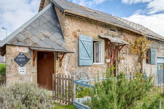
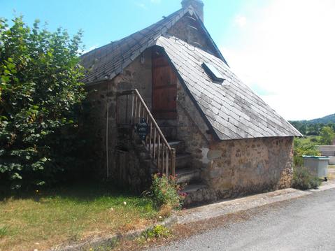
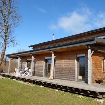
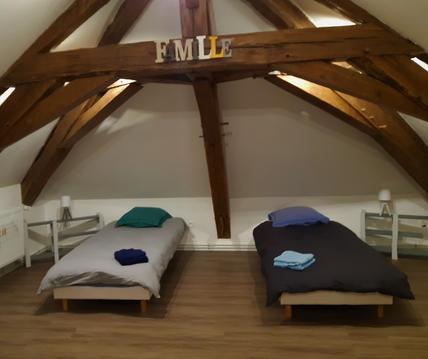
Hébergements à proximité

infos parcours (15)
1
Parking à la Verrerie
Informations complémentaires
kilomètre
0,00
latitude
47.0192
altitude
478
m
longitude
4.1159
2
Chemin carrossable à droite
Informations complémentaires
kilomètre
0,38
latitude
47.0166
altitude
442
m
longitude
4.11646
3
Conduite forcée
Informations complémentaires
kilomètre
0,67
latitude
47.0162
altitude
458
m
longitude
4.11272
4
Par la gauche, traverser la
Informations complémentaires
kilomètre
1,90
latitude
47.0091
altitude
555
m
longitude
4.1052
5
Quitter la D179, virer à droite
Informations complémentaires
kilomètre
3,70
latitude
47.001
altitude
597
m
longitude
4.09099
6
Gros chemin à gauche
Informations complémentaires
kilomètre
4,24
latitude
46.9991
altitude
604
m
longitude
4.0847
7
A gauche sur la route forestière
Informations complémentaires
kilomètre
5,61
latitude
47.0051
altitude
629
m
longitude
4.07484
8
A gauche vers Château-Chinon
Informations complémentaires
kilomètre
9,51
latitude
47.03
altitude
600
m
longitude
4.09111
9
Tout droit
Informations complémentaires
kilomètre
10,70
latitude
47.0354
altitude
626
m
longitude
4.09433
10
A gauche sur le chemin
Informations complémentaires
kilomètre
11,63
latitude
47.033
altitude
644
m
longitude
4.10153
11
A droite au cimetière
Informations complémentaires
kilomètre
13,39
latitude
47.0265
altitude
550
m
longitude
4.11538
12
Chemin à gauche
Informations complémentaires
kilomètre
13,99
latitude
47.0257
altitude
585
m
longitude
4.10779
13
A droite aux Guillaumes
Informations complémentaires
kilomètre
14,36
latitude
47.0225
altitude
554
m
longitude
4.10857
14
A droite
Informations complémentaires
kilomètre
15,08
latitude
47.0206
altitude
529
m
longitude
4.10498
15
Parking à la Verrerie
Informations complémentaires
kilomètre
33,22
latitude
47.0192
altitude
478
m
longitude
4.1159
GILLES
Note moyenne
Cartes associées
