
Roche Mathiole
- Mis à jour le 14/06/2025
- Identifiant 2745435
Sélectionner le fond de carte

PLAN IGN

PHOTOS AERIENNES

CARTES IGN MULTI-ECHELLES

TOP 25 IGN

CARTES DES PENTES

PARCELLES CADASTRALES

CARTES OACI

CARTES 1950 IGN

CARTE DE L’ETAT-MAJOR (1820-1866)

Open Street Map
Afficher les points d'intérêt à proximité
Hébergements
Informations
Lieux d'intérêts
Producteurs
Restauration
Services et Commerces
Autre
Echelle
|
durée / niveau
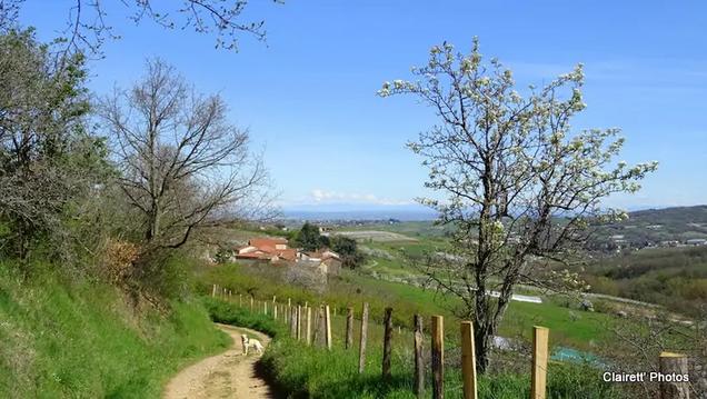
Rando pédestre
|
distance
7,7 km
type parcours
|
|||||||||
|
Lieu de départ
202 Chemin la Chap de Chateauvieux
69510 YZERON |
accessibilite
|
|||||||||
|
prestations payantes
Non
|
type(s) de sol
|
|||||||||
description
Au départ de Châteauvieux
Hébergements à proximité


Points d'interêt (2)
A
69670 VAUGNERAY
Voir la fiche du point d'intéret »
Le Dolmen
Lieu historique
Informations complémentaires
69670 VAUGNERAY
kilomètre
0,76
latitude
45.7084
altitude
583
m
longitude
4.62505
B
Voir la fiche du point d'intéret »
Chapelle de Châteauvieux
Château
Informations complémentaires
76 Chemin chapelle de Châteauvieux
69510 YZERON
69510 YZERON
kilomètre
7,44
latitude
45.7066
altitude
676
m
longitude
4.61666
J-Claude
Note moyenne
Cartes associées
