
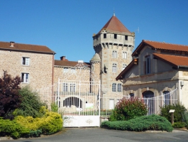
De Sainte-Foy-l'Argentière à Saint-Symphorien-sur-Coise
- Mis à jour le 23/12/2024
- Identifiant 2811251
Sélectionner le fond de carte

PLAN IGN

PHOTOS AERIENNES

CARTES IGN MULTI-ECHELLES

TOP 25 IGN

CARTES DES PENTES

PARCELLES CADASTRALES

CARTES OACI

CARTES 1950 IGN

CARTE DE L’ETAT-MAJOR (1820-1866)

Open Street Map
Afficher les points d'intérêt à proximité
Hébergements
Informations
Lieux d'intérêts
Producteurs
Restauration
Services et Commerces
Autre
Echelle
|
durée / niveau
Rando pédestre
|
distance
14,2 km
type parcours
|
|||||||||
|
Lieu de départ
3 Route de Lyon
69610 SAINTE-FOY-L'ARGENTIÈRE |
accessibilite
|
|||||||||
|
prestations payantes
Non
|
type(s) de sol
|
|||||||||
Photos & vidéos (1)
|
description
Entre les monts du Beaujolais et le massif du Pilat, aux portes des métropoles de Lyon et Saint-Étienne, ce territoire aux doux vallons verdoyants est ponctué de villages et hameaux accueillants.
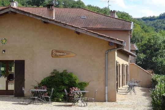
Hébergements à proximité
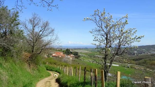


Balisage
Jaune et rouge (GR® de Pays des Monts du Lyonnais) et balisage jaune
infos parcours (19)
1
Le Camard
Informations complémentaires
3 Route de Lyon
69610 SAINTE-FOY-L'ARGENTIÈRE
69610 SAINTE-FOY-L'ARGENTIÈRE
kilomètre
0,00
latitude
45.7099
altitude
425
m
longitude
4.46706
2
Le Rossignol
Informations complémentaires
60 Chemin de la Diligence
69610 SOUZY
69610 SOUZY
kilomètre
1,63
latitude
45.7038
altitude
470
m
longitude
4.45256
3
Rue de l'Etang
Informations complémentaires
1115 Chemin du Noisetier
69610 AVEIZE
69610 AVEIZE
kilomètre
3,13
latitude
45.6913
altitude
454
m
longitude
4.453
4
Le Noisetier
Informations complémentaires
515 Chemin du Noisetier
69610 AVEIZE
69610 AVEIZE
kilomètre
3,61
latitude
45.6875
altitude
475
m
longitude
4.4513
5
Altitude 485
Informations complémentaires
80 Chemin des Noisetiers
69610 MEYS
69610 MEYS
kilomètre
3,87
latitude
45.6856
altitude
485
m
longitude
4.44948
6
Les Esparcieux
Informations complémentaires
55 Chemin Des Esparcieux
69610 AVEIZE
69610 AVEIZE
kilomètre
4,98
latitude
45.6806
altitude
581
m
longitude
4.44717
7
Bas de Huras
Informations complémentaires
170 Chemin Des Esparcieux
69610 AVEIZE
69610 AVEIZE
kilomètre
5,12
latitude
45.6801
altitude
587
m
longitude
4.44879
8
Les Deux Croix
Informations complémentaires
12 Le Fourchet
69610 GRÉZIEU-LE-MARCHÉ
69610 GRÉZIEU-LE-MARCHÉ
kilomètre
6,80
latitude
45.6684
altitude
730
m
longitude
4.45408
9
La Planche
Informations complémentaires
Le Viricel
69610 AVEIZE
69610 AVEIZE
kilomètre
7,19
latitude
45.6664
altitude
686
m
longitude
4.45777
10
Le Viricel
Informations complémentaires
12 Le Viricel
69610 GRÉZIEU-LE-MARCHÉ
69610 GRÉZIEU-LE-MARCHÉ
kilomètre
7,39
latitude
45.6658
altitude
696
m
longitude
4.45565
11
Barrage de la Gimond
Informations complémentaires
364 Chemin du Moulin Simonet
69610 GRÉZIEU-LE-MARCHÉ
69610 GRÉZIEU-LE-MARCHÉ
kilomètre
8,14
latitude
45.6642
altitude
657
m
longitude
4.44742
12
69590 POMEYS
Bois de Pomey
Informations complémentaires
69590 POMEYS
kilomètre
9,29
latitude
45.6563
altitude
706
m
longitude
4.44082
13
Le Crêt
Informations complémentaires
439 Montée Saint Martin
69590 POMEYS
69590 POMEYS
kilomètre
9,96
latitude
45.6514
altitude
729
m
longitude
4.43721
14
Pomeys - Le Bourg
Informations complémentaires
429 Rue du Tilleul
69590 POMEYS
69590 POMEYS
kilomètre
10,52
latitude
45.6499
altitude
682
m
longitude
4.44348
15
Les écoles
Informations complémentaires
1267 Route de la Mathevonnière
69590 POMEYS
69590 POMEYS
kilomètre
10,60
latitude
45.6492
altitude
675
m
longitude
4.44356
16
Pluvy- Le Bas
Informations complémentaires
100 Chemin du Grand Pré
69590 POMEYS
69590 POMEYS
kilomètre
12,08
latitude
45.6391
altitude
606
m
longitude
4.44483
17
Pluvy
Informations complémentaires
790 Allée de Pluvy
69590 POMEYS
69590 POMEYS
kilomètre
12,41
latitude
45.6367
altitude
624
m
longitude
4.44719
18
La Doue
Informations complémentaires
1 Rue de Chazelles
69590 SAINT-SYMPHORIEN-SUR-COISE
69590 SAINT-SYMPHORIEN-SUR-COISE
kilomètre
13,34
latitude
45.6311
altitude
559
m
longitude
4.45284
19
Place Charles De Gaulle
Parking - Arrêt du Car du Rhône 2EX (direction Lyon-Gorge-de-Loup)http://www.carsdurhone.fr/sites/carsdurhone/files/medias/documents/2023-12/Ligne%202Ex%20CHAZELLES%20-%20LYON%20%E2%80%93%202023%202024_Janvier%202024_v3.pdf
Informations complémentaires
98 Boulevard du 11 Novembre
69590 SAINT-SYMPHORIEN-SUR-COISE
69590 SAINT-SYMPHORIEN-SUR-COISE
kilomètre
14,15
latitude
45.6303
altitude
576
m
longitude
4.45675

