
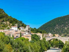
Nyons 1
- Mis à jour le 19/04/2025
- Identifiant 2843454
Sélectionner le fond de carte

PLAN IGN

PHOTOS AERIENNES

CARTES IGN MULTI-ECHELLES

TOP 25 IGN

CARTES DES PENTES

PARCELLES CADASTRALES

CARTES OACI

CARTES 1950 IGN

CARTE DE L’ETAT-MAJOR (1820-1866)

Open Street Map
Afficher les points d'intérêt à proximité
Hébergements
Informations
Lieux d'intérêts
Producteurs
Restauration
Services et Commerces
Autre
Echelle
|
durée / niveau
Rando pédestre
|
distance
20,7 km
type parcours
|
|||||||||
|
Lieu de départ
Nyons
|
accessibilite
|
|||||||||
|
prestations payantes
Non
|
type(s) de sol
|
|||||||||
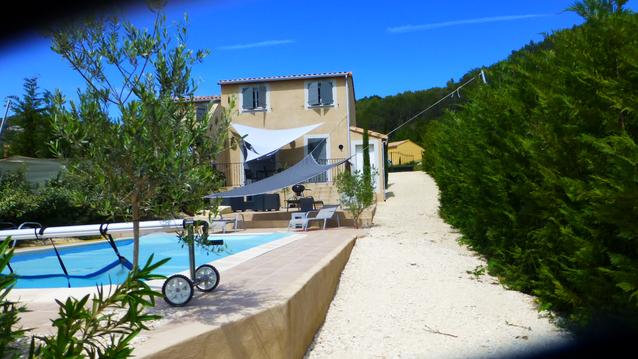
Photos & vidéos (1)
|
description
Élisabeth Dubost IBP 96
Hébergements à proximité

infos parcours (11)
1
rejoindre trace aller
Informations complémentaires
kilomètre
16,18
latitude
44.3517
altitude
558
m
longitude
5.1584
2
observatoire après 550
Informations complémentaires
kilomètre
15,19
latitude
44.3465
altitude
564
m
longitude
5.15373
3
chapelle Rimbert
Informations complémentaires
kilomètre
28,02
latitude
44.349
altitude
429
m
longitude
5.14019
4
source les blaches
Informations complémentaires
kilomètre
29,05
latitude
44.3428
altitude
460
m
longitude
5.13251
5
pointe sud 643
Informations complémentaires
kilomètre
30,43
latitude
44.3321
altitude
638
m
longitude
5.13437
6
garde crosse
Informations complémentaires
kilomètre
32,48
latitude
44.3365
altitude
927
m
longitude
5.15506
7
col croix
Informations complémentaires
kilomètre
33,85
latitude
44.3467
altitude
701
m
longitude
5.16473
8
début sentier
Informations complémentaires
kilomètre
34,72
latitude
44.3531
altitude
750
m
longitude
5.16405
9
extrémité Nord
Informations complémentaires
kilomètre
36,50
latitude
44.3687
altitude
498
m
longitude
5.15999
10
épingle5
Informations complémentaires
kilomètre
25,24
latitude
44.3523
altitude
555
m
longitude
5.1586
11
pt 399
Informations complémentaires
kilomètre
39,53
latitude
44.3521
altitude
398
m
longitude
5.15542
Regis
Note moyenne
Cartes associées
