
Clan St Maurice Annecy_Jour 2 _ Signal de Malheibiau jusqu'au Gibertès
- Mis à jour le 30/05/2025
- Identifiant 2907796
Sélectionner le fond de carte

PLAN IGN

PHOTOS AERIENNES

CARTES IGN MULTI-ECHELLES

TOP 25 IGN

CARTES DES PENTES

PARCELLES CADASTRALES

CARTES OACI

CARTES 1950 IGN

CARTE DE L’ETAT-MAJOR (1820-1866)

Open Street Map
Afficher les points d'intérêt à proximité
Hébergements
Informations
Lieux d'intérêts
Producteurs
Restauration
Services et Commerces
Autre
Echelle
|
durée / niveau
Rando pédestre
|
distance
25,4 km
type parcours
Aller Simple
|
|||||||||
|
Lieu de départ
48340
|
accessibilite
|
|||||||||
|
prestations payantes
Non
|
type(s) de sol
Graviers
Terre Herbe Rochers |
|||||||||
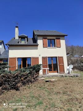
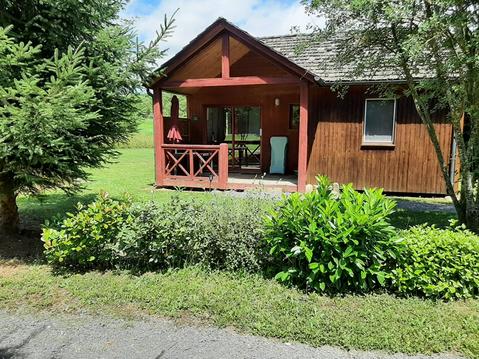
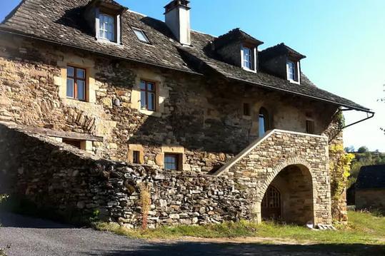
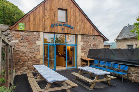
Hébergements à proximité

infos parcours (15)
1
48340
Informations complémentaires
kilomètre
0,00
latitude
44.567
altitude
1469
m
longitude
3.08226
2
48100
Informations complémentaires
kilomètre
2,12
latitude
44.5767
altitude
1384
m
longitude
3.06567
3
48100
Informations complémentaires
kilomètre
3,93
latitude
44.5788
altitude
1387
m
longitude
3.0871
4
48100
Informations complémentaires
kilomètre
5,08
latitude
44.5755
altitude
1323
m
longitude
3.09969
5
48100
Informations complémentaires
kilomètre
6,65
latitude
44.5714
altitude
1327
m
longitude
3.11751
6
48100
Informations complémentaires
kilomètre
8,39
latitude
44.5649
altitude
1390
m
longitude
3.13511
7
48100
Informations complémentaires
kilomètre
10,46
latitude
44.5579
altitude
1361
m
longitude
3.1583
8
48100
Informations complémentaires
kilomètre
11,67
latitude
44.5661
altitude
1268
m
longitude
3.16467
9
48100
Informations complémentaires
kilomètre
13,39
latitude
44.5768
altitude
1169
m
longitude
3.15663
10
48100
Informations complémentaires
kilomètre
15,27
latitude
44.5843
altitude
1236
m
longitude
3.17536
11
48100
Informations complémentaires
kilomètre
17,73
latitude
44.5972
altitude
1239
m
longitude
3.19714
12
48100
Informations complémentaires
kilomètre
19,14
latitude
44.6055
altitude
1204
m
longitude
3.20627
13
48100
Informations complémentaires
kilomètre
20,73
latitude
44.6065
altitude
1312
m
longitude
3.20063
14
48100
Informations complémentaires
kilomètre
21,95
latitude
44.6114
altitude
1223
m
longitude
3.19936
15
7 Rue du Pré des Pommiers, Le Buisson, 48100
Informations complémentaires
kilomètre
25,38
latitude
44.63
altitude
1159
m
longitude
3.20933
Benoît

Note moyenne
Cartes associées
