
La brèche au diable 9 et 12 km
- Thématique Balade
- Mis à jour le 17/08/2025
- Identifiant 3023564
Sélectionner le fond de carte

PLAN IGN

PHOTOS AERIENNES

CARTES IGN MULTI-ECHELLES

TOP 25 IGN

CARTES DES PENTES

PARCELLES CADASTRALES

CARTES OACI

CARTES 1950 IGN

CARTE DE L’ETAT-MAJOR (1820-1866)

Open Street Map
Afficher les points d'intérêt à proximité
Hébergements
Informations
Lieux d'intérêts
Producteurs
Restauration
Services et Commerces
Autre
Echelle
|
durée / niveau
Rando pédestre
|
distance
11,7 km
type parcours
Boucle
|
|||||||||
|
Lieu de départ
14 Rue Marie Elisabeth Joly
14420 Soumont-Saint-Quentin |
accessibilite
|
|||||||||
|
prestations payantes
Non
|
type(s) de sol
Bitume
Terre Herbe |
|||||||||
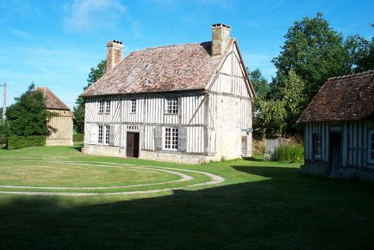
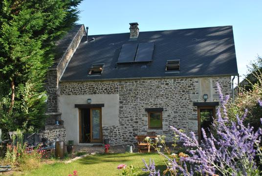
Photos & vidéos (1)

|
description
Randonnée dans le secteur du tombeau de Marie Joly et de vestige archéologique dans la vallée du Laizon. Autres curiosité : Falaise avec site d'escalade et Manoir de Ouilly le Tesson.
Hébergements à proximité

infos parcours (23)
1
14190
Informations complémentaires
kilomètre
4,74
latitude
48.9926
altitude
92
m
longitude
-0.204623
2
14 Rue Marie Elisabeth Joly, Soumont-Saint-Quentin, 14420
Informations complémentaires
kilomètre
0,02
latitude
48.9697
altitude
162
m
longitude
-0.221033
3
14420
Informations complémentaires
kilomètre
0,49
latitude
48.9696
altitude
142
m
longitude
-0.223123
4
14420
Informations complémentaires
kilomètre
10,41
latitude
48.9715
altitude
125
m
longitude
-0.223749
5
14420
Informations complémentaires
kilomètre
13,28
latitude
48.9723
altitude
119
m
longitude
-0.221348
6
14420
Informations complémentaires
kilomètre
14,08
latitude
48.9774
altitude
138
m
longitude
-0.216739
7
14190
Informations complémentaires
kilomètre
14,97
latitude
48.977
altitude
149
m
longitude
-0.205818
8
14190
Informations complémentaires
kilomètre
15,62
latitude
48.9807
altitude
123
m
longitude
-0.210833
9
14190
Informations complémentaires
kilomètre
16,71
latitude
48.9874
altitude
82
m
longitude
-0.205333
10
1 Chemin du Pirot, Ouilly-le-Tesson, 14190
Informations complémentaires
kilomètre
17,05
latitude
48.9883
altitude
89
m
longitude
-0.201441
11
13 Chemin du Pirot, Ouilly-le-Tesson, 14190
Informations complémentaires
kilomètre
17,37
latitude
48.9899
altitude
96
m
longitude
-0.197968
12
14190
Informations complémentaires
kilomètre
17,86
latitude
48.9929
altitude
75
m
longitude
-0.196858
13
14 Rue Marie Elisabeth Joly, Soumont-Saint-Quentin, 14420
Informations complémentaires
kilomètre
23,41
latitude
48.9698
altitude
163
m
longitude
-0.221242
14
2 Chemin du Manoir, Ouilly-le-Tesson, 14190
Informations complémentaires
kilomètre
19,48
latitude
48.9895
altitude
107
m
longitude
-0.213986
15
3 Chemin du Manoir, Ouilly-le-Tesson, 14190
Informations complémentaires
kilomètre
19,58
latitude
48.9886
altitude
104
m
longitude
-0.214176
16
8 Rue du Prônet, Ouilly-le-Tesson, 14190
Informations complémentaires
kilomètre
19,86
latitude
48.9888
altitude
105
m
longitude
-0.2175
17
7 Chemin des Rotours, Ouilly-le-Tesson, 14190
Informations complémentaires
kilomètre
20,40
latitude
48.9854
altitude
99
m
longitude
-0.220143
18
14420
Informations complémentaires
kilomètre
21,30
latitude
48.9777
altitude
108
m
longitude
-0.22057
19
14420
Informations complémentaires
kilomètre
21,98
latitude
48.9736
altitude
138
m
longitude
-0.226718
20
14420
Informations complémentaires
kilomètre
22,22
latitude
48.9727
altitude
160
m
longitude
-0.227704
21
14420
Informations complémentaires
kilomètre
22,50
latitude
48.9716
altitude
160
m
longitude
-0.224584
22
14420
Informations complémentaires
kilomètre
22,67
latitude
48.9709
altitude
150
m
longitude
-0.224944
23
14420
Informations complémentaires
kilomètre
23,11
latitude
48.969
altitude
147
m
longitude
-0.220618


