
Autours de Fontenay sur eure
- Thématique Balade
- Mis à jour le 04/06/2015
- Identifiant 12772
Sélectionner le fond de carte

PLAN IGN

PHOTOS AERIENNES

CARTES IGN MULTI-ECHELLES

TOP 25 IGN

CARTES DES PENTES

PARCELLES CADASTRALES

CARTES OACI

CARTES 1950 IGN

CARTE DE L’ETAT-MAJOR (1820-1866)

Open Street Map
Afficher les points d'intérêt à proximité
Hébergements
Informations
Lieux d'intérêts
Producteurs
Restauration
Services et Commerces
Autre
Echelle
|
durée / niveau
Rando pédestre
|
distance
11,5 km
type parcours
Boucle
|
|||||||||
|
Lieu de départ
65 r noel ballay
28630 Fontenay-sur-Eure |
accessibilite
|
|||||||||
|
prestations payantes
Non
|
type(s) de sol
Bitume
Terre Herbe |
|||||||||
description
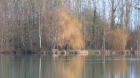
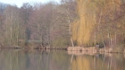
Découverte des étangs
Hébergements à proximité


notes, commentaires & photos (2)
PHILIPPE
le 25/11/2018 à 10:42
balade autour des étangs
|
|
PHILIPPE
le 26/11/2018 à 11:24
guy
Note moyenne
Cartes associées
