
Clan St Maurice Annecy_Jour 1 _ Prades d_Aubrac jusqu_au signal de Mailhebiau
- Mis à jour le 30/05/2025
- Identifiant 2907777
Sélectionner le fond de carte

PLAN IGN

PHOTOS AERIENNES

CARTES IGN MULTI-ECHELLES

TOP 25 IGN

CARTES DES PENTES

PARCELLES CADASTRALES

CARTES OACI

CARTES 1950 IGN

CARTE DE L’ETAT-MAJOR (1820-1866)

Open Street Map
Afficher les points d'intérêt à proximité
Hébergements
Informations
Lieux d'intérêts
Producteurs
Restauration
Services et Commerces
Autre
Echelle
|
durée / niveau
Rando pédestre
|
distance
24,0 km
type parcours
Aller Simple
|
|||||||||
|
Lieu de départ
4213 Route de l’Aubrac
12470 Prades-d'Aubrac |
accessibilite
|
|||||||||
|
prestations payantes
Non
|
type(s) de sol
Bitume
Graviers Terre Herbe Rochers |
|||||||||
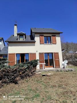
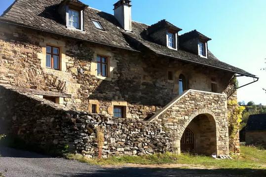
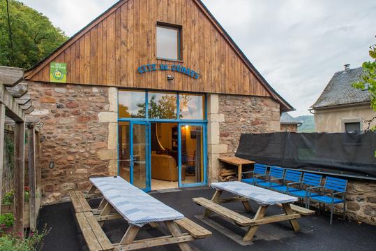
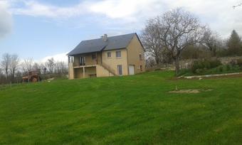
Hébergements à proximité

infos parcours (11)
1
4213 Route de l’Aubrac, Prades-d'Aubrac, 12470
Informations complémentaires
kilomètre
0,00
latitude
44.5334
altitude
867
m
longitude
2.93899
2
3594 Route de l’Aubrac, Prades-d'Aubrac, 12470
Informations complémentaires
kilomètre
0,62
latitude
44.5317
altitude
849
m
longitude
2.94551
3
1367 Route des Crouzets, Prades-d'Aubrac, 12470
Informations complémentaires
kilomètre
4,46
latitude
44.5431
altitude
994
m
longitude
2.97529
4
254 Route du Vialaret, Prades-d'Aubrac, 12470
Informations complémentaires
kilomètre
5,04
latitude
44.5398
altitude
983
m
longitude
2.97916
5
12470
Informations complémentaires
kilomètre
7,09
latitude
44.5559
altitude
1053
m
longitude
2.98838
6
50 Rue Basse, Prades-d'Aubrac, 12470
Informations complémentaires
kilomètre
8,10
latitude
44.5496
altitude
1053
m
longitude
2.99169
7
12470
Informations complémentaires
kilomètre
10,76
latitude
44.5618
altitude
1132
m
longitude
3.01783
8
12470
Informations complémentaires
kilomètre
16,37
latitude
44.5905
altitude
1346
m
longitude
3.01568
9
48260
Informations complémentaires
kilomètre
18,20
latitude
44.5976
altitude
1342
m
longitude
3.03214
10
48100
Informations complémentaires
kilomètre
21,80
latitude
44.577
altitude
1382
m
longitude
3.06526
11
48340
Informations complémentaires
kilomètre
23,93
latitude
44.5669
altitude
1468
m
longitude
3.08179
Benoît

Note moyenne
Cartes associées

Vous aimerez aussi
Le Chemin de Saint-Guilhem par le GR®6 variante des Gorges du Tarn (d'Aumont-Aubrac aux Vignes)
Historique, patrimoine
114.1 km
| par Parc Naturel Régional de l'Aubrac |
Chemin de St Guilhem - 4/14 - de St Chély d'Aubrac à Plagnes
Itinérance, road-trip
23.7 km
| par Vincent |