
SITE DU GUE DE SELLE
- Thématique
- Mis à jour le 07/04/2025
Sélectionner le fond de carte

PLAN IGN

PHOTOS AERIENNES

CARTES IGN MULTI-ECHELLES

TOP 25 IGN

CARTES DES PENTES

PARCELLES CADASTRALES

CARTES OACI

CARTES 1950 IGN

CARTE DE L’ETAT-MAJOR (1820-1866)

Open Street Map
Afficher les points d'intérêt à proximité
Hébergements
Informations
Lieux d'intérêts
Producteurs
Restauration
Services et Commerces
Autre
Echelle
|
latitude
48.1974
|
longitude
-0.433515
|
altitude
108 m
|
|||
|
adresse
53600 MEZANGERS
|
accessibilite
|
||||
Photos & vidéos (2)
|
|
description
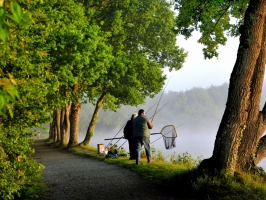
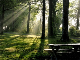
Pêche, baignade libre (non surveillée), base de loisirs (pédalos, canoë, planche, swin-golf...), vous pouvez faire tout cela au Gué de Selle. Il est également possible de vous promener le tour de l'étang en suivant un parcours botanique qui fait découvrir aux promeneurs les différentes espèces d'arbres présentes sur une distance de 3125 mètres. Idéal pour une ballade dominicale !
Contact
Email : info.evron@coevrons-tourisme.com
Téléphone : 02 43 01 63 75
Fax : 02 43 01 63 75
Téléphone : 02 43 01 63 75
Fax : 02 43 01 63 75
Réseau e-SPRIT
Note moyenne