
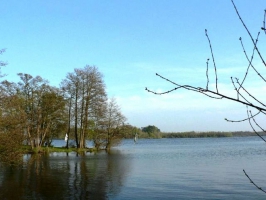
LES PLAINES DE MAZEROLLES
- Thématique
- Mis à jour le 13/03/2025
Sélectionner le fond de carte

PLAN IGN

PHOTOS AERIENNES

CARTES IGN MULTI-ECHELLES

TOP 25 IGN

CARTES DES PENTES

PARCELLES CADASTRALES

CARTES OACI

CARTES 1950 IGN

CARTE DE L’ETAT-MAJOR (1820-1866)

Open Street Map
Afficher les points d'intérêt à proximité
Hébergements
Informations
Lieux d'intérêts
Producteurs
Restauration
Services et Commerces
Autre
Echelle
|
latitude
47.3653
|
longitude
-1.50144
|
altitude
5 m
|
|||
|
adresse
Ile de Mazerolles
44240 SUCE-SUR-ERDRE |
accessibilite
|
||||
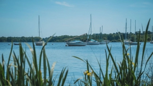
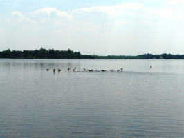
Photos & vidéos (4)
|
|

|
|
description
Ce lieu est surtout très fréquenté par les touristes souhaitant avoir une vision générale de la plaine de Mazerolles. Il est très apprécié des Nantais souhaitant prendre un bol d'air au bord de l'eau. Du parking, on accède par un chemin à une presqu'île permettant d'observer la totalité du plan d'eau.
Contact
Email : accueil-suce@erdrecanalforet.fr
Téléphone : 02 40 77 70 66
Téléphone : 02 40 77 70 66
Réseau e-SPRIT
Note moyenne