
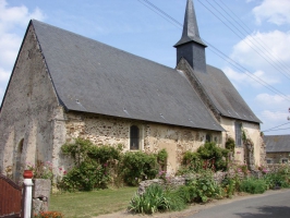
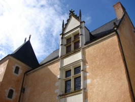
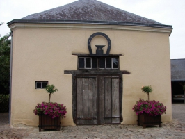
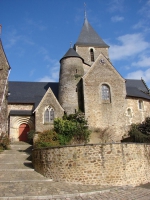
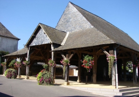
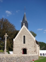
Village médiéval Saint-Denis-d'Anjou
- Thématique
- Mis à jour le 14/04/2025
Sélectionner le fond de carte

PLAN IGN

PHOTOS AERIENNES

CARTES IGN MULTI-ECHELLES

TOP 25 IGN

CARTES DES PENTES

PARCELLES CADASTRALES

CARTES OACI

CARTES 1950 IGN

CARTE DE L’ETAT-MAJOR (1820-1866)

Open Street Map
Afficher les points d'intérêt à proximité
Hébergements
Informations
Lieux d'intérêts
Producteurs
Restauration
Services et Commerces
Autre
Echelle
|
latitude
47.7909
|
longitude
-0.442493
|
altitude
54 m
|
|||
|
adresse
53290 SAINT-DENIS-D'ANJOU
|
accessibilite
|
||||
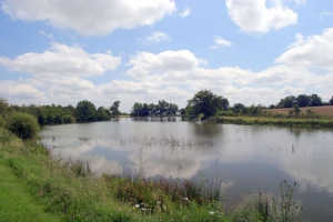
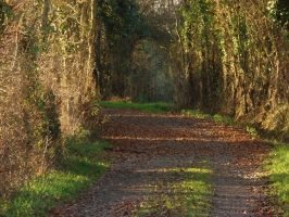
Photos & vidéos (9)
|
|
|
|
|

|
|
|
|
description
Situé dans le sud Mayenne, aux confins du Maine et Loire et de la Sarthe, Saint Denis d'Anjou est un joyau médiéval à visiter sans modération ! Une des 7 petites cités de caractère de la Mayenne, en Vallée de la Sarthe, vous y trouverez un patrimoine architectural remarquable.> Visite toute l'année sur réservation> Individuels 4€ (-10 ans gratuit)> Visite de ville ou de la chapelle de St Martin ou de la chapelle de Varennes : adulte 4€ (-10 ans gratuit) / Famille 14€ / Groupe 35€ (- 10 ans gratuit)
Accueil des animaux ?
Animaux acceptés : oui
Modes de paiement
Chèques bancaires et postaux
Chèques Vacances
Espèces
Chèques Vacances
Espèces
Lien(s)
Contact
Email : officedetourismesda@gmail.com
Téléphone : 02 43 70 69 09
Téléphone : 02 43 70 69 09
Réseau e-SPRIT
Note moyenne