
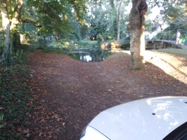
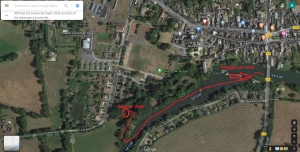
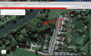
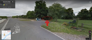
Parking arrivée à la cale de VAAS
- Thématique Informations
- Mis à jour le 10/08/2023
Sélectionner le fond de carte

PLAN IGN

PHOTOS AERIENNES

CARTES IGN MULTI-ECHELLES

TOP 25 IGN

CARTES DES PENTES

PARCELLES CADASTRALES

CARTES OACI

CARTES 1950 IGN

CARTE DE L’ETAT-MAJOR (1820-1866)

Open Street Map
Afficher les points d'intérêt à proximité
Hébergements
Informations
Lieux d'intérêts
Producteurs
Restauration
Services et Commerces
Autre
Echelle
|
latitude
47.6661
|
longitude
0.31141
|
altitude
41 m
|
|||
|
adresse
72500 Vaas
|
accessibilite
|
||||
|
services à proximité
Parking
|
|||||
|
Mots clés
rivière, kayak, canoë, Sarthe, Loir, descente, Cale, Mise-à-l'eau
|
|||||
Photos & vidéos (4)
|
|
|
|
description
La rue est calme avec de nombreuses places de stationnement, l'accès à la cale est en terre, possibilité de se garer dans le champs mitoyen.