Saint-Victor-de-Buthon (5 TP)
- Thématique Informations
- Mis à jour le 16/02/2021
Sélectionner le fond de carte

PLAN IGN

PHOTOS AERIENNES

CARTES IGN MULTI-ECHELLES

TOP 25 IGN

CARTES DES PENTES

PARCELLES CADASTRALES

CARTES OACI

CARTES 1950 IGN

CARTE DE L’ETAT-MAJOR (1820-1866)

Open Street Map
Afficher les points d'intérêt à proximité
Hébergements
Informations
Lieux d'intérêts
Producteurs
Restauration
Services et Commerces
Autre
Echelle
|
latitude
48.41
|
longitude
0.96874
|
altitude
219 m
|
|||
|
adresse
28240 Saint-Victor-de-Buthon
|
accessibilite
|
||||
|
services à proximité
Parking
|
|||||
|
Mots clés
Eure-et-Loir, Normandie, Parc-Naturel-Régional-du-Perche, Traversées-Percheronnes, Saint-Victor-de-Buthon, Le-Perche
|
|||||
Photos & vidéos (6)
|
|
|
|
|
description
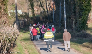
Un village de caractère avec de nombreux atouts pour le randonneur. La commune est dotée de nombreux chemins balisés, (elle est un centre de VTT), qui offrent de véritables parcours de découverte des patrimoines naturel et bâti percherons. On y trouve également des traces de forteresses des Xème et XIIème siècles. Les étangs de Perruchet, en limite de la commune de Saint-Eliph, sont une autre richesse.
L’église, d’origine romane et enrichie dans les siècles qui suivirent, possède un riche mobilier.
L’église, d’origine romane et enrichie dans les siècles qui suivirent, possède un riche mobilier.
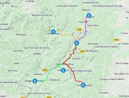
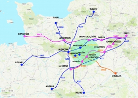
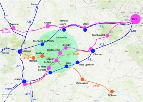
Les 5 Traversées Percheronnes au départ de Saint-Victor-de-Buthon
Bretoncelles - Saint-Victor-de-Buthon 10 km, 2h30
https://ignrando.fr/fr/parcours/fiche/details/id/960537/
Coudreceau - Saint-Victor-de-Buthon 11,5 km, 3h
https://ignrando.fr/fr/parcours/fiche/details/id/989886/
La Loupe - Saint-Victor-de-Buthon 10 km, 3h45
https://ignrando.fr/fr/parcours/fiche/details/id/1078853/
Nogent-le-Rotrou - Saint-Victor-de-Buthon 19 km, 5h
https://ignrando.fr/fr/parcours/fiche/details/id/1080154/
Saint-Victor-de-Buthon - Thiron-Gardais 17 km, 4h15
https://ignrando.fr/fr/parcours/fiche/details/id/1081493/
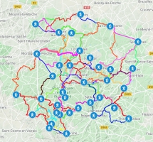
CARTE INTERACTIVE
Le lien suivant donne accès à une carte interactive qui renvoit tous les liens de chaque itinéraire et points d'intérêt (villes étapes) sur les différentes plateformes dépositaires (IGNrando, Sitytrail et CIRKWI)
https://www.google.com/maps/d/edit?mid=11JCxORSiTdACdg17a7IXOCn6ciq5JQbe&usp=sharing
https://www.google.com/maps/d/edit?mid=11JCxORSiTdACdg17a7IXOCn6ciq5JQbe&usp=sharing
Note moyenne


