Monceaux-au-Perche (3 TP)
- Thématique Informations
- Mis à jour le 19/04/2021
Sélectionner le fond de carte

PLAN IGN

PHOTOS AERIENNES

CARTES IGN MULTI-ECHELLES

TOP 25 IGN

CARTES DES PENTES

PARCELLES CADASTRALES

CARTES OACI

CARTES 1950 IGN

CARTE DE L’ETAT-MAJOR (1820-1866)

Open Street Map
Afficher les points d'intérêt à proximité
Hébergements
Informations
Lieux d'intérêts
Producteurs
Restauration
Services et Commerces
Autre
Echelle
|
latitude
48.4841
|
longitude
0.704618
|
altitude
159 m
|
|||
|
adresse
61290 Longny les Villages
|
accessibilite
|
||||
|
services à proximité
Parking
|
|||||
|
Mots clés
Normandie, Orne, Parc-Naturel-Régional-du-Perche, Traversées-Percheronnes, Le-Perche, Monceay-au-Perche
|
|||||
Photos & vidéos (6)
|
|
|
|
|
description
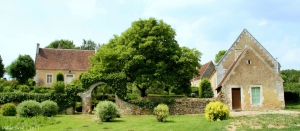
Le petit village de Monceaux-au-Perche est niché dans la vallée, au confluent de la Commeauche et de la Jambée, entre la forêt de Réno-Valdieu à l’ouest et de grands bois à l’est, idéalement situé pour les randonnées. Le patrimoine bâti est également bien représenté avec l’église, romane d’origine, et les manoirs du Pontgirard et du Gué.
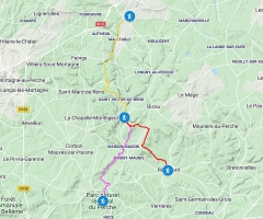
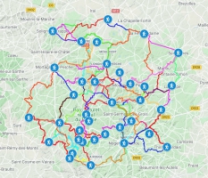
Les 3 Traversées Percheronnes au départ de Monceaux-au-Perche
L'Hôme-Chamondot - Monceaux-au-Perche 17 km, 4h30
https://ignrando.fr/fr/parcours/fiche/details/id/1078749/
Monceaux-au-Perche - Nocé-Courboyer 15 km, 3h45
https://ignrando.fr/fr/parcours/fiche/details/id/1079751/
Monceaux-au-Perche - Rémalard 11 km, 3h
https://ignrando.fr/fr/parcours/fiche/details/id/1079763/
https://ignrando.fr/fr/parcours/fiche/details/id/1078749/
Monceaux-au-Perche - Nocé-Courboyer 15 km, 3h45
https://ignrando.fr/fr/parcours/fiche/details/id/1079751/
Monceaux-au-Perche - Rémalard 11 km, 3h
https://ignrando.fr/fr/parcours/fiche/details/id/1079763/


