Mortagne-au-Perche (5 TP)
- Thématique Informations
- Mis à jour le 19/01/2021
Sélectionner le fond de carte

PLAN IGN

PHOTOS AERIENNES

CARTES IGN MULTI-ECHELLES

TOP 25 IGN

CARTES DES PENTES

PARCELLES CADASTRALES

CARTES OACI

CARTES 1950 IGN

CARTE DE L’ETAT-MAJOR (1820-1866)

Open Street Map
Afficher les points d'intérêt à proximité
Hébergements
Informations
Lieux d'intérêts
Producteurs
Restauration
Services et Commerces
Autre
Echelle
|
latitude
48.5216
|
longitude
0.5456
|
altitude
251 m
|
|||
|
adresse
61400 Mortagne-au-Perche
|
accessibilite
|
||||
|
services à proximité
Banque, Distributeur argent
Accessibilité PHMR
Hôpital
Parking
Pharmacie
Point d’eau potable
Poste de secours
Poste, boîte à lettres
Supermarché, épicerie
Station-service
Taxi
Toilettes publiques
Transports en commun
|
|||||
|
Mots clés
Normandie, Orne, Mortagne-au-Perche, Parc-Naturel-Régional-du-Perche, Traversées-Percheronnes, Le-Perche
|
|||||
Photos & vidéos (6)
|
|
|
|
|
description
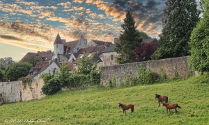
Mortagne-au-Perche est l’une des anciennes capitales historiques du comté du Perche. La petite ville assise sur une imposante colline surplombant la plaine a conservé un beau patrimoine. Parmi les lieux à découvrir, citons l’église Notre dame, la Porte Saint-Denis, la maison des comtes du Perche, le couvent Saint-François et son cloître, des demeures du XVIème siècle et des hôtels particuliers du XVIIIème siècle.
Mortagne offre un large choix de commerce et d’artisanat, sans oublier son marché du samedi avec ses produits locaux et régionaux dont le célèbre boudin noir.
Mortagne offre un large choix de commerce et d’artisanat, sans oublier son marché du samedi avec ses produits locaux et régionaux dont le célèbre boudin noir.
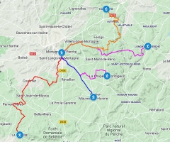
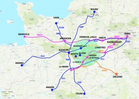
les 5 Traversées Percheronnes au départ de Mortagne-au-Perche
La Chapelle-Montligeon – Mortagne-au-Perche 14 km, 3h30
https://ignrando.fr/fr/parcours/fiche/details/id/262523/
La Perrière - Mortagne-au-Perche (TCP) 29 km, 7h15
https://ignrando.fr/fr/parcours/fiche/details/id/1078937/
Longny-au-Perche - Mortagne-au-Perche 21 km, 5h30
https://ignrando.fr/fr/parcours/fiche/details/id/264926/
Mauves-sur-Huisne - Mortagne-au-Perche 11 km, 3h
https://ignrando.fr/fr/parcours/fiche/details/id/386349/
Mortagne-au-Perche - Tourouvre (TCP) 25 km, 6h30
https://ignrando.fr/fr/parcours/fiche/details/id/1079771/
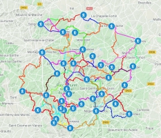
CARTE INTERACIVE :
Le lien suivant donne accès à une carte interactive qui renvoie tous les liens de chaque itinéraire et points d'intérêt (villes étapes) sur les différentes plateformes dépositaires (IGNrando, Sitytrail et CIRKWI)
https://www.google.com/maps/d/edit?mid=11JCxORSiTdACdg17a7IXOCn6ciq5JQbe&usp=sharing
https://www.google.com/maps/d/edit?mid=11JCxORSiTdACdg17a7IXOCn6ciq5JQbe&usp=sharing
Note moyenne


