
Le Canal de Carentan
- Thématique Lieux d'intérêt
- Mis à jour le 22/06/2016
Sélectionner le fond de carte

PLAN IGN

PHOTOS AERIENNES

CARTES IGN MULTI-ECHELLES

TOP 25 IGN

CARTES DES PENTES

PARCELLES CADASTRALES

CARTES OACI

CARTES 1950 IGN

CARTE DE L’ETAT-MAJOR (1820-1866)

Open Street Map
Afficher les points d'intérêt à proximité
Hébergements
Informations
Lieux d'intérêts
Producteurs
Restauration
Services et Commerces
Autre
Echelle
|
latitude
49.3402
|
longitude
-1.18886
|
altitude
-2 m
|
|||
|
adresse
Le Feu
50500 BRÉVANDS |
accessibilite
|
||||
Photos & vidéos (1)
|
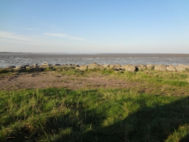
description
Napoléon avait décidé de creuser un canal reliant Carentan à la côte ouest "Le Canal du Cotentin", il ne put achever son œuvre. Au loin, on aperçoit de l'autre côté de la Baie des Veys l'église de Sainte-Marie-du-Mont (XIe-XIIIe siècle) dont le clocher est le plus haut de la presqu'île.
