
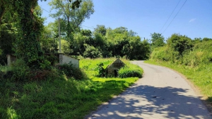
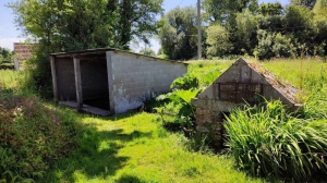
Lavoir et sa fontaine
- Thématique Lieux d'intérêt
- Mis à jour le 21/06/2024
Sélectionner le fond de carte

PLAN IGN

PHOTOS AERIENNES

CARTES IGN MULTI-ECHELLES

TOP 25 IGN

CARTES DES PENTES

PARCELLES CADASTRALES

CARTES OACI

CARTES 1950 IGN

CARTE DE L’ETAT-MAJOR (1820-1866)

Open Street Map
Afficher les points d'intérêt à proximité
Hébergements
Informations
Lieux d'intérêts
Producteurs
Restauration
Services et Commerces
Autre
Echelle
|
latitude
48.7375
|
longitude
-3.35453
|
altitude
34 m
|
|||
|
adresse
6 Route de Kerfant
22300 LANMÉRIN |
accessibilite
|
||||
Photos & vidéos (2)
|
|
description
Petit patrimoine chargé d'histoire. Un lavoir avec sa fontaine sur le bas coté de la route
