
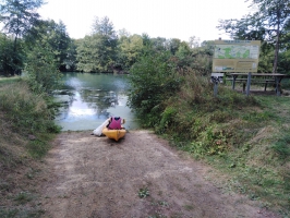
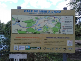
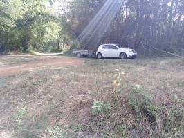
Cale de mise à l'eau de la Bruère sur le Loir
- Thématique Informations
- Mis à jour le 10/08/2023
Sélectionner le fond de carte

PLAN IGN

PHOTOS AERIENNES

CARTES IGN MULTI-ECHELLES

TOP 25 IGN

CARTES DES PENTES

PARCELLES CADASTRALES

CARTES OACI

CARTES 1950 IGN

CARTE DE L’ETAT-MAJOR (1820-1866)

Open Street Map
Afficher les points d'intérêt à proximité
Hébergements
Informations
Lieux d'intérêts
Producteurs
Restauration
Services et Commerces
Autre
Echelle
|
latitude
47.6611
|
longitude
0.341499
|
altitude
42 m
|
|||
|
adresse
72500 Vaas
|
accessibilite
|
||||
|
Mots clés
kayak, Sarthe, Loir, descente, cale, canoë-kayak
|
|||||
Photos & vidéos (3)
|
|
|
description
Petit coin tranquille pour vous mettre à l'eau, en sortir ou pour une pose pique-nique. Situé entre Nogent et Vaas.