
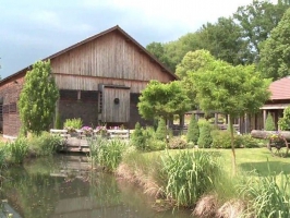
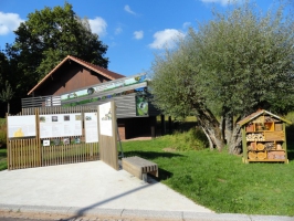
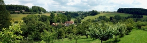
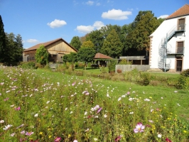
Site du Moulin d'Eschviller à Volmunster
- Thématique Lieux d'intérêt
- Mis à jour le 16/03/2021
Sélectionner le fond de carte

PLAN IGN

PHOTOS AERIENNES

CARTES IGN MULTI-ECHELLES

TOP 25 IGN

CARTES DES PENTES

PARCELLES CADASTRALES

CARTES OACI

CARTES 1950 IGN

CARTE DE L’ETAT-MAJOR (1820-1866)

Open Street Map
Afficher les points d'intérêt à proximité
Hébergements
Informations
Lieux d'intérêts
Producteurs
Restauration
Services et Commerces
Autre
Echelle
|
latitude
49.1358
|
longitude
7.36556
|
altitude
247 m
|
|||
|
adresse
Volmunster
|
accessibilite
|
||||
Photos & vidéos (4)
|
|
|
|
description
Le site du moulin d'Eschviller propose plusieurs facettes d'un patrimoine naturel et culturel.Il raconte avant tout l'histoire d'un territoire rural, de ses habitants et de la façon dont ils ont exploité et exploitent encore leurs ressources naturelles. Plus d’infos ici.
