Repère de nivellement Q'.F.N3R3 - 19
- Thématique Lieux d'intérêt
- Mis à jour le 22/01/2018
Sélectionner le fond de carte

PLAN IGN

PHOTOS AERIENNES

CARTES IGN MULTI-ECHELLES

TOP 25 IGN

CARTES DES PENTES

PARCELLES CADASTRALES

CARTES OACI

CARTES 1950 IGN

CARTE DE L’ETAT-MAJOR (1820-1866)

Open Street Map
Afficher les points d'intérêt à proximité
Hébergements
Informations
Lieux d'intérêts
Producteurs
Restauration
Services et Commerces
Autre
Echelle
|
latitude
45.2886
|
longitude
3.74868
|
altitude
1061 m
|
|||
|
adresse
43160 Félines
|
accessibilite
|
||||
Photos & vidéos (3)

|

|

|
description
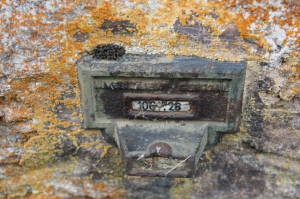
Matricule : Q'.F.N3R3 - 19 1 061,459 m
Année de dernière détermination : 1977 ALTITUDE NORMALE
Repère vu en place en 2000 et en 2017
Type : C REPERE CONSOLE
Complément :
Voie suivie : VOIE FERREE
de : CRAPONNE-SUR-ARZON à : SEMBADEL
Coté : Droit PK : 63,53 km Distance : -
Localisation : AU PASSAGE A NIVEAU NO.141 D'UN CHEMIN
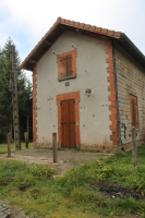
Support : ANCIENNE MAISON DE GARDE-BARRIERE
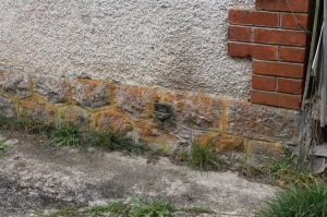
Partie support : MUR PIGNON , FACE VOIE
Repèrements : A 0.65 M DE L'EXTREMITE COTE "CRAPONNE"
A 0.23 M AU-DESSUS DU SOL
Note moyenne


