
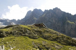
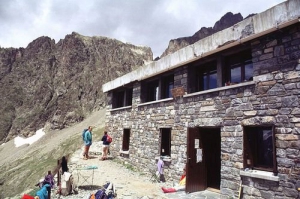
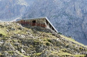
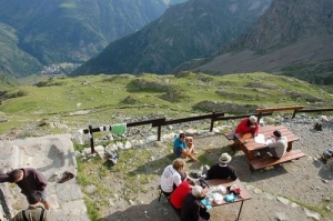
Refuge de l'Olan
- Thématique Hébergements
- Mis à jour le 19/05/2016
Sélectionner le fond de carte

PLAN IGN

PHOTOS AERIENNES

CARTES IGN MULTI-ECHELLES

TOP 25 IGN

CARTES DES PENTES

PARCELLES CADASTRALES

CARTES OACI

CARTES 1950 IGN

CARTE DE L’ETAT-MAJOR (1820-1866)

Open Street Map
Afficher les points d'intérêt à proximité
Hébergements
Informations
Lieux d'intérêts
Producteurs
Restauration
Services et Commerces
Autre
Echelle
|
latitude
44.8415
|
longitude
6.2039
|
altitude
2318 m
|
|||
|
adresse
La chapelle-en-valgaudemar
|
accessibilite
|
||||
Photos & vidéos (4)
|
|
|
|
description
Situé à 2350 m d'altitude, ce gros bâtiment construit en 1957 fut emporté par une avalanche deux ans plus tard. En témoigne une dalle de béton en contre-bas du refuge. Reconstruit en 1966, il est définitivement agrandi en 1978 avec une capacité de 54 places. Étape sur le Tour de l'Oisans (GR 54), il accueille les randonneurs à la belle saison et possède un abri d'hiver, il appartient au Club Alpin Français.

Parc national des Ecrins
Note moyenne
Parcours avec ce point d'intérêt
181.4 km
| par Parc national des Ecrins |